
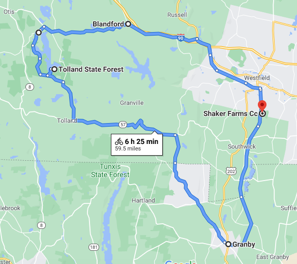
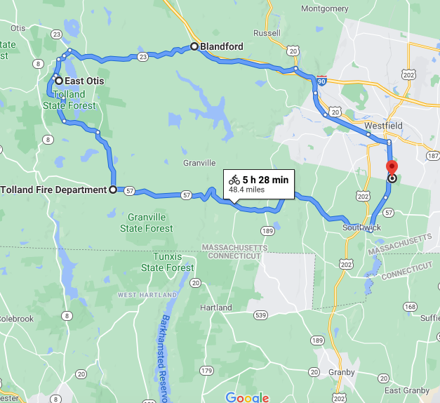
For my second ride of the fundraiser, I planned to ride out west into Berkshire County, then come back on a more southerly route, including a dip into Connecticut, as seen on the map above (click on images to see larger version). This ride did not begin from my house – instead I drove with my bike to Westfield, MA, and parked by the bike trail there (in a little lot at the Shaker Farms country club).
I began the ride by heading north on the trail, and I got off before the northern end, so that I could check out a new mural I had read about. The trail is elevated to the north of the Little River, and it has a few bridges over roads and at least one tunnel – in this case there is a bit of trail that passes through a tunnel under the main trail, connecting 2 residential streets. These murals painted in the tunnel were recently completed:
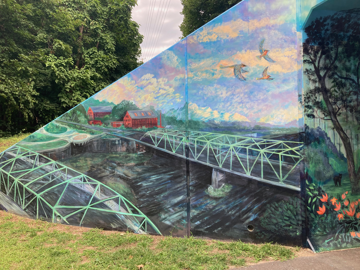
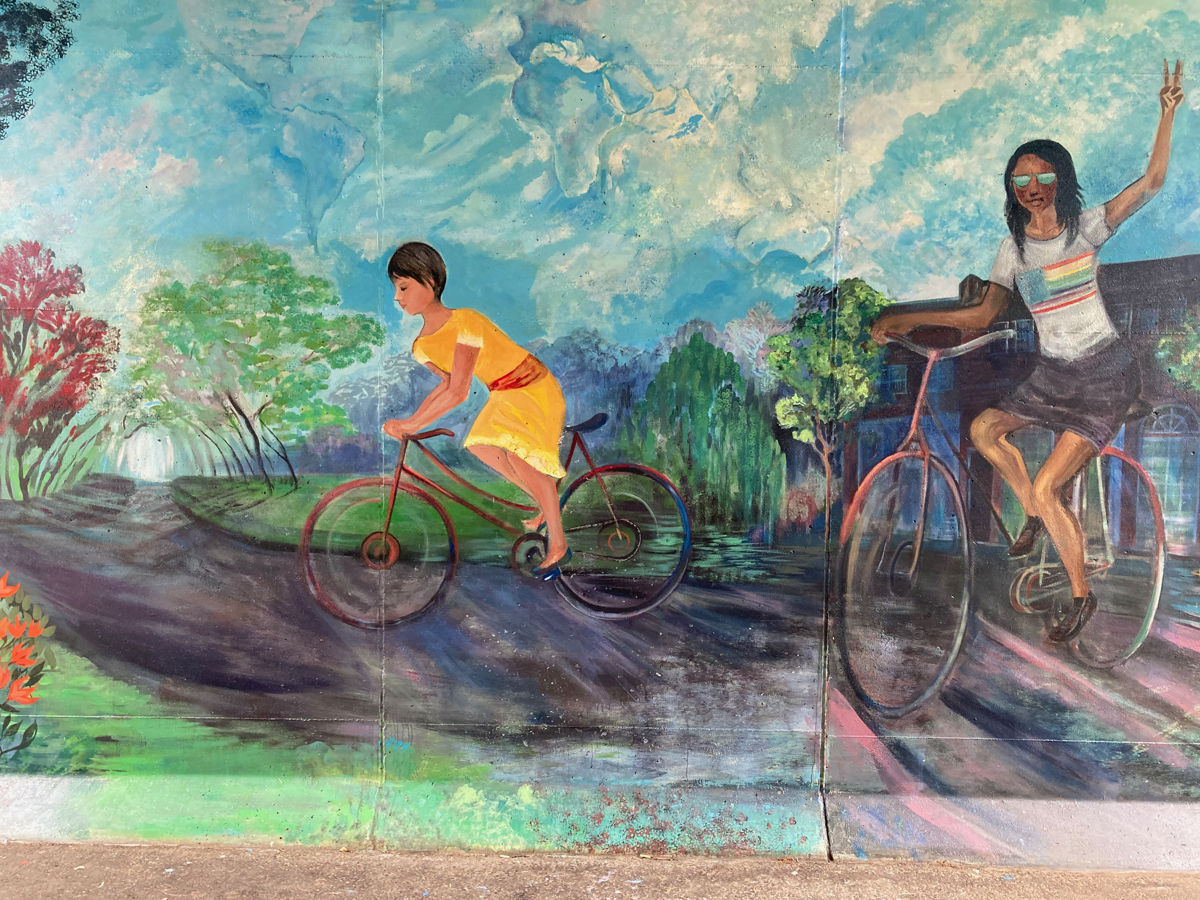
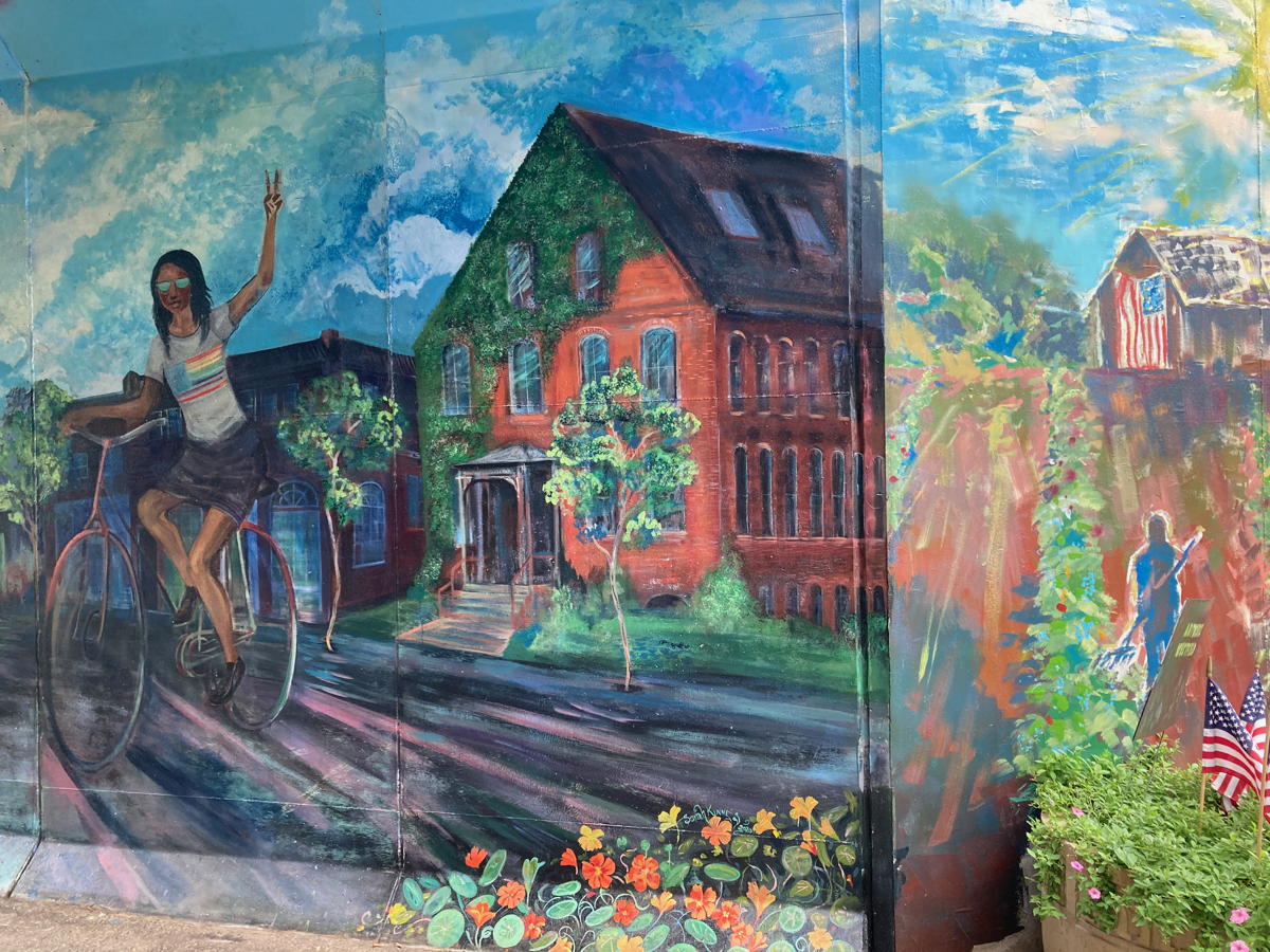
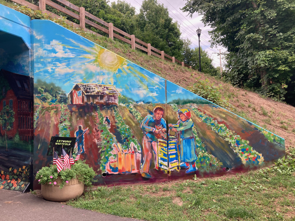
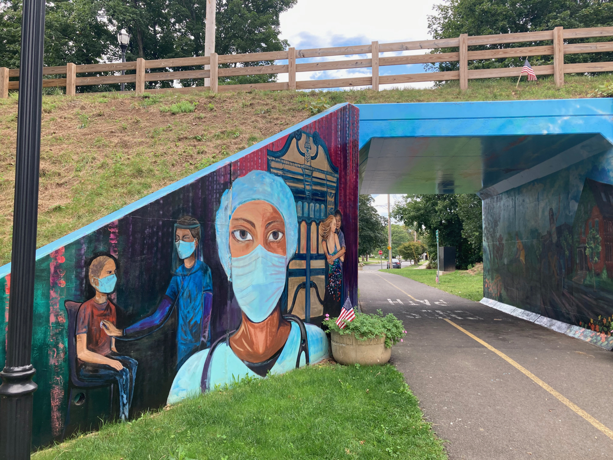
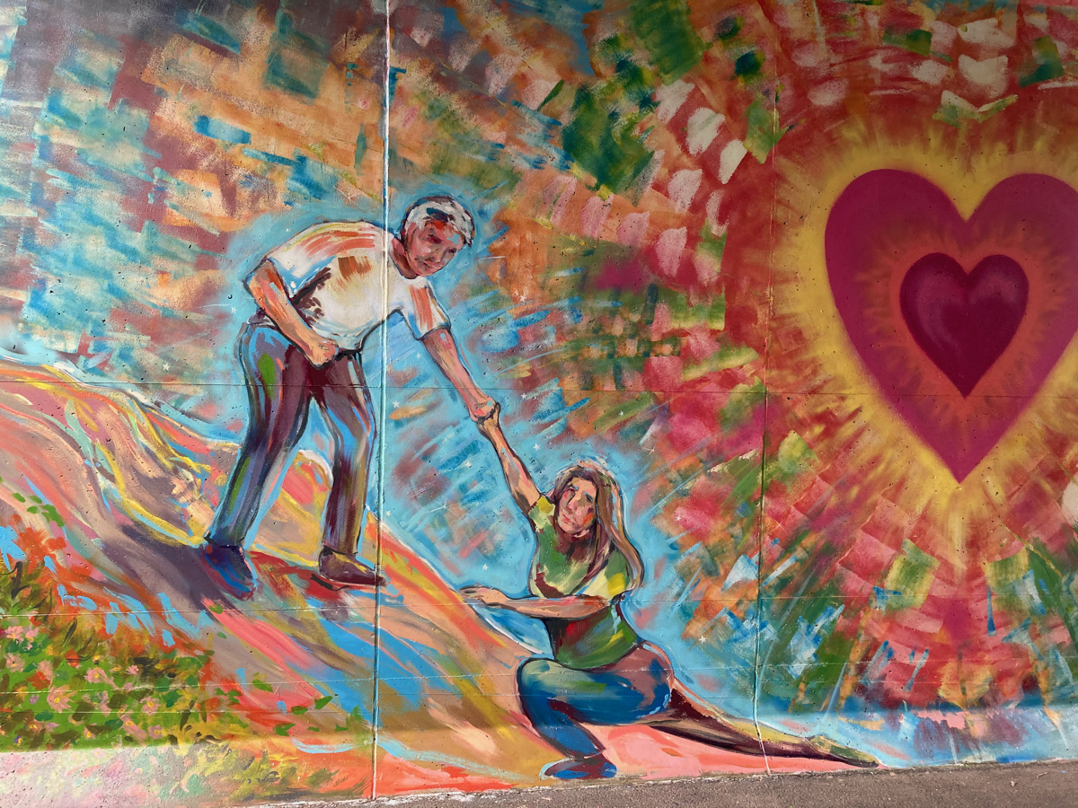
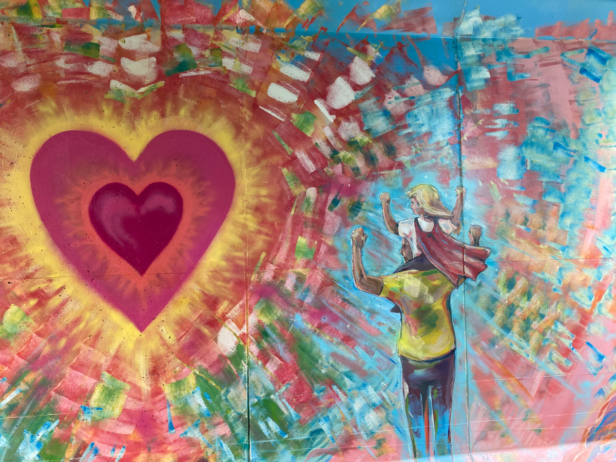
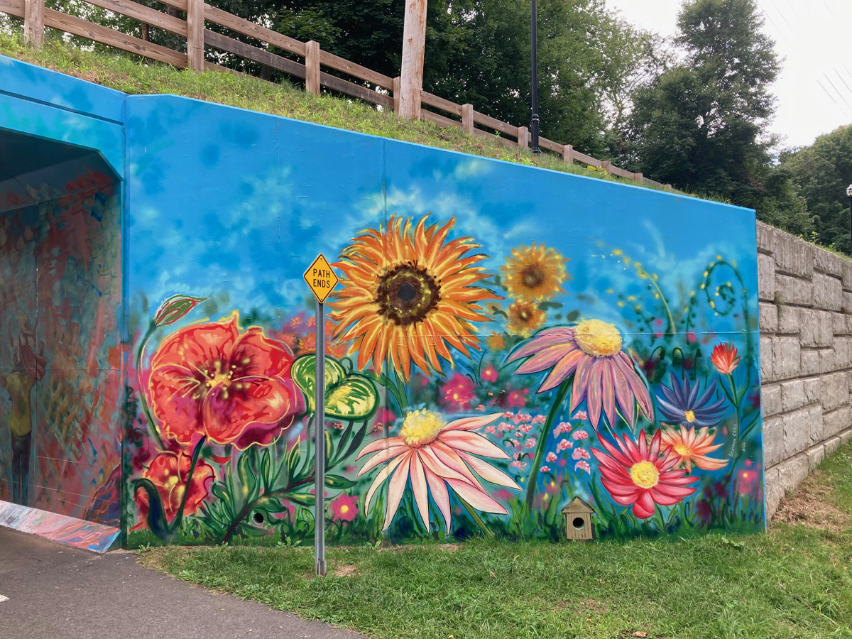
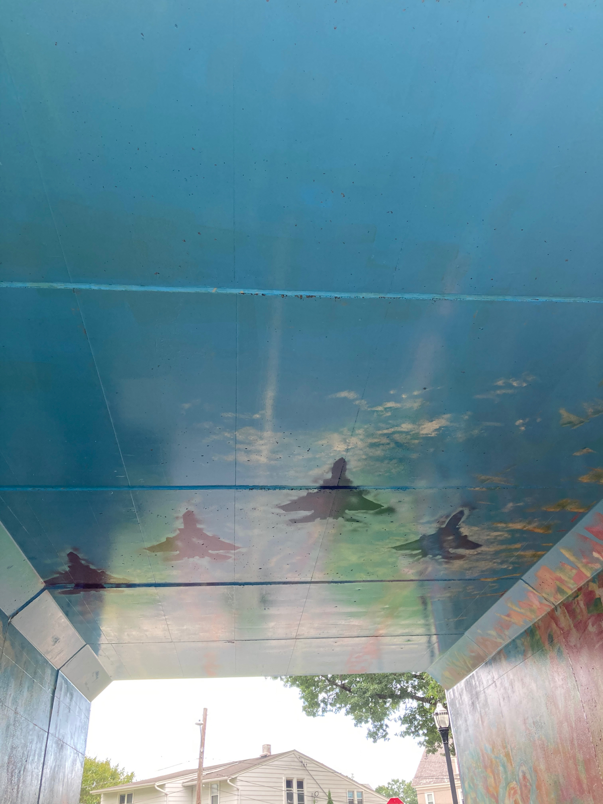
The mural images depict several aspects of the City of Westfield. That first one shows the bridges that carry routes 10 and 202 over the Westfield River, the health care workers are likely in honor of staff at Noble Hospital and Western Mass. Hospital, and the fighter jets refer to the National Guard air wing that is stationed at Barnes Airport, as examples.
From there I left the trail and headed westward, passing the campus of Westfield State University, and making my way to US 20. On 20, I passed the town line into Russel, and then came to this high overpass:
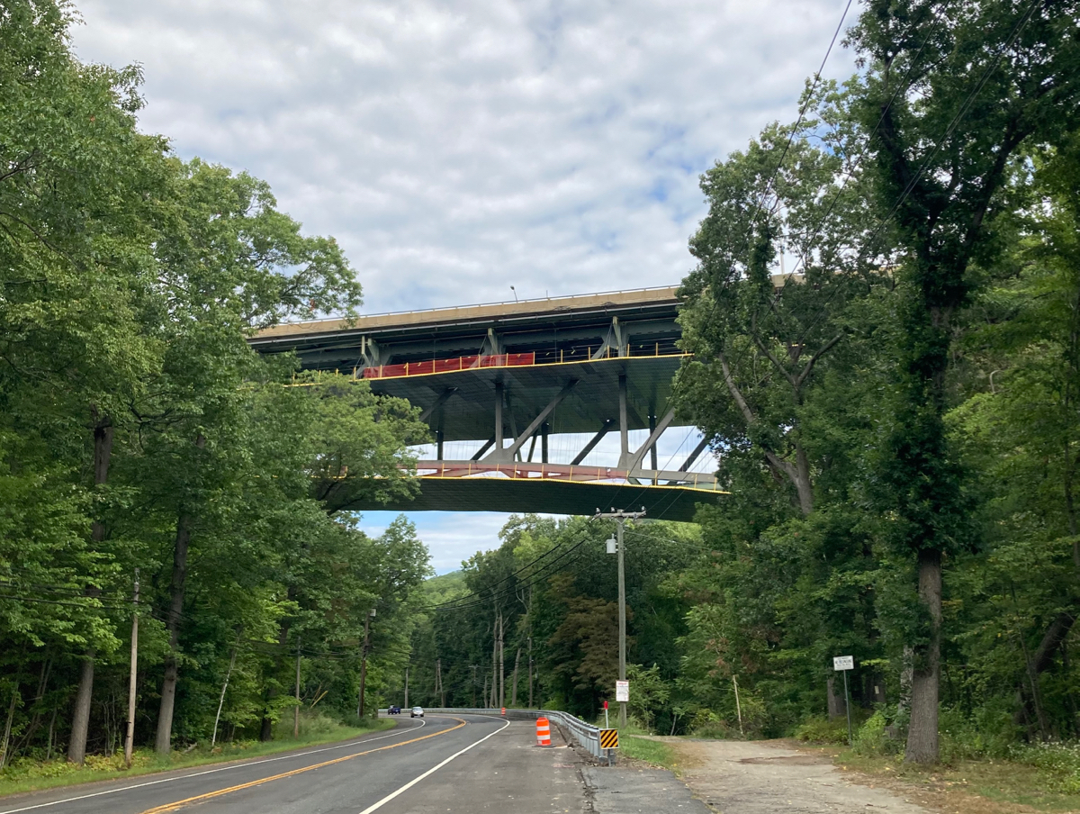
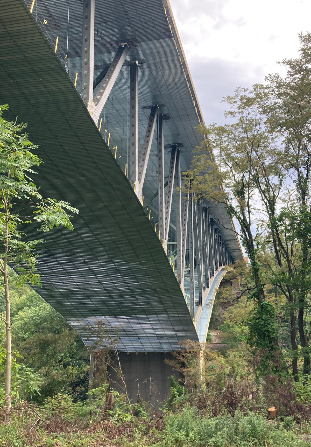
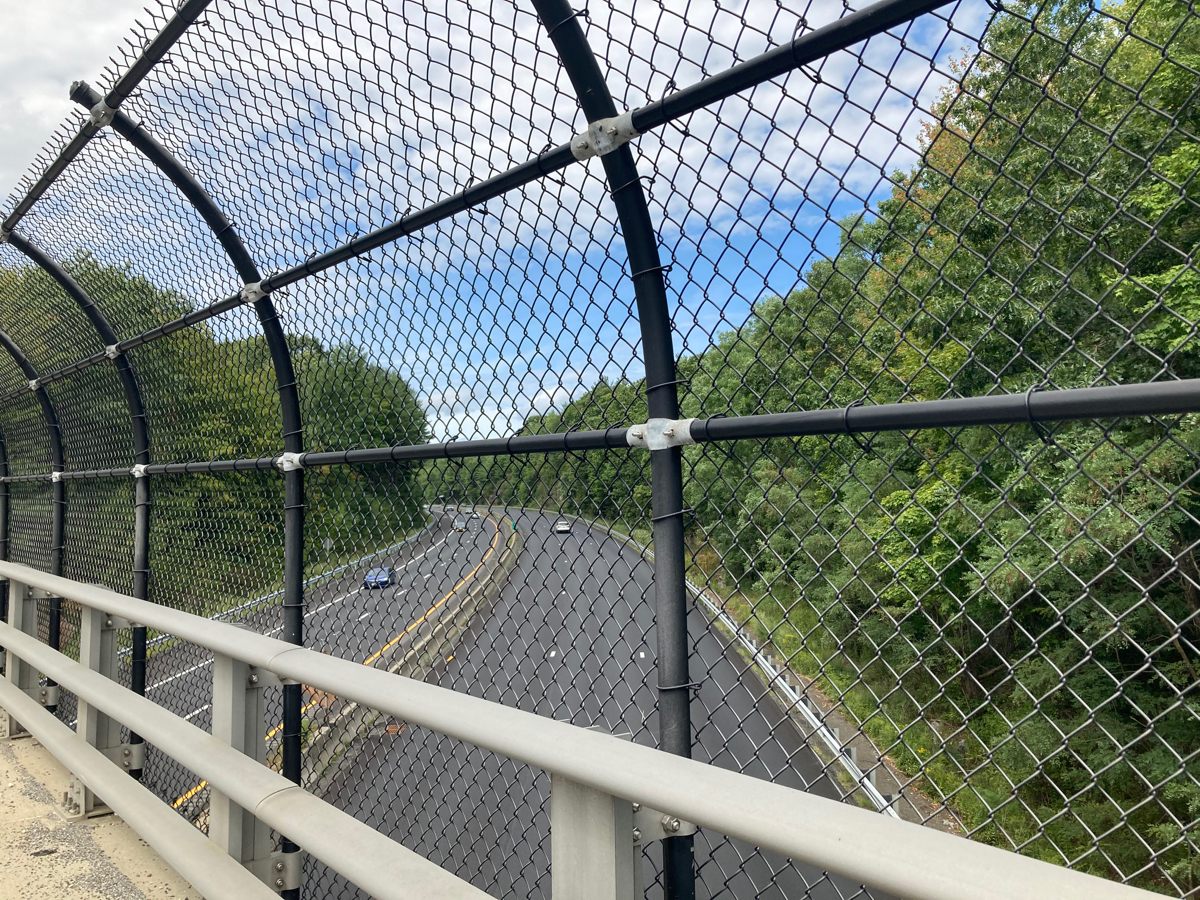
That’s the Mass Pike (aka the Massachusetts Turnpike, aka Interstate 90). That is actually a fairly long bridge that carries the Pike over Route 20, the Westfield River, and some railroad tracks. Here’s a view along the bridge (which clearly seemed to be under construction), looking east:
I continued west on 20 for a bit, and then turned onto Route 23, where I began to climb. Then I climbed some more, and more yet. This was the most prolonged climbing of the day – the first mile on 23 is constant climbing, and then the next 3 miles after that has a bit of level riding, but is mostly uphill.
Just after that first mile, the road crosses over the Mass Pike:
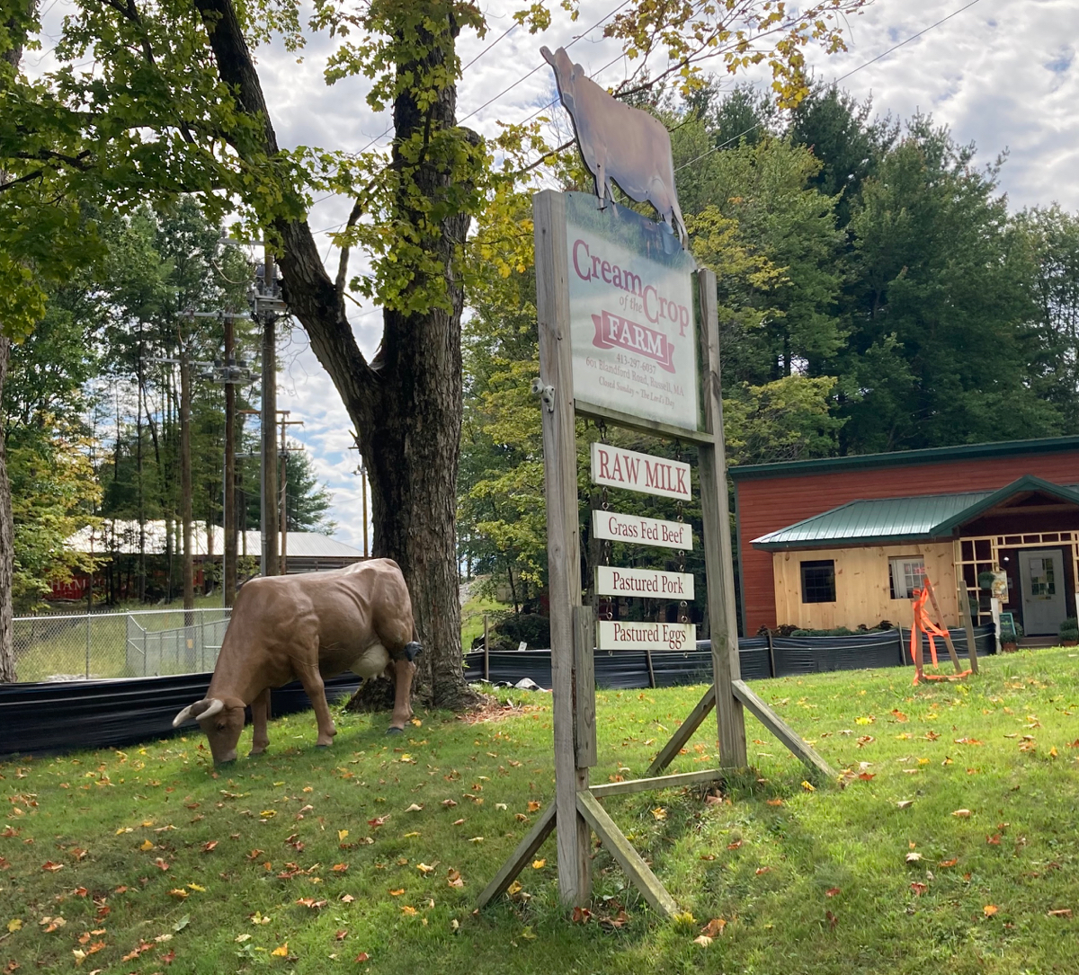
Just after that crossing, I noticed a cow by the side of the road, though not a real cow:
On the climb, I passed into the town of Blandford, and eventually got to Blandford center. At that point I’d been on route 23 for about 4 miles, almost all of which was uphill. As I contined west I got some nice downhil riding, interspersed with some more uphill stretches. I stopped off by this nice scene just before one uphill bit:
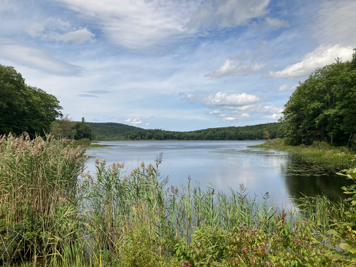
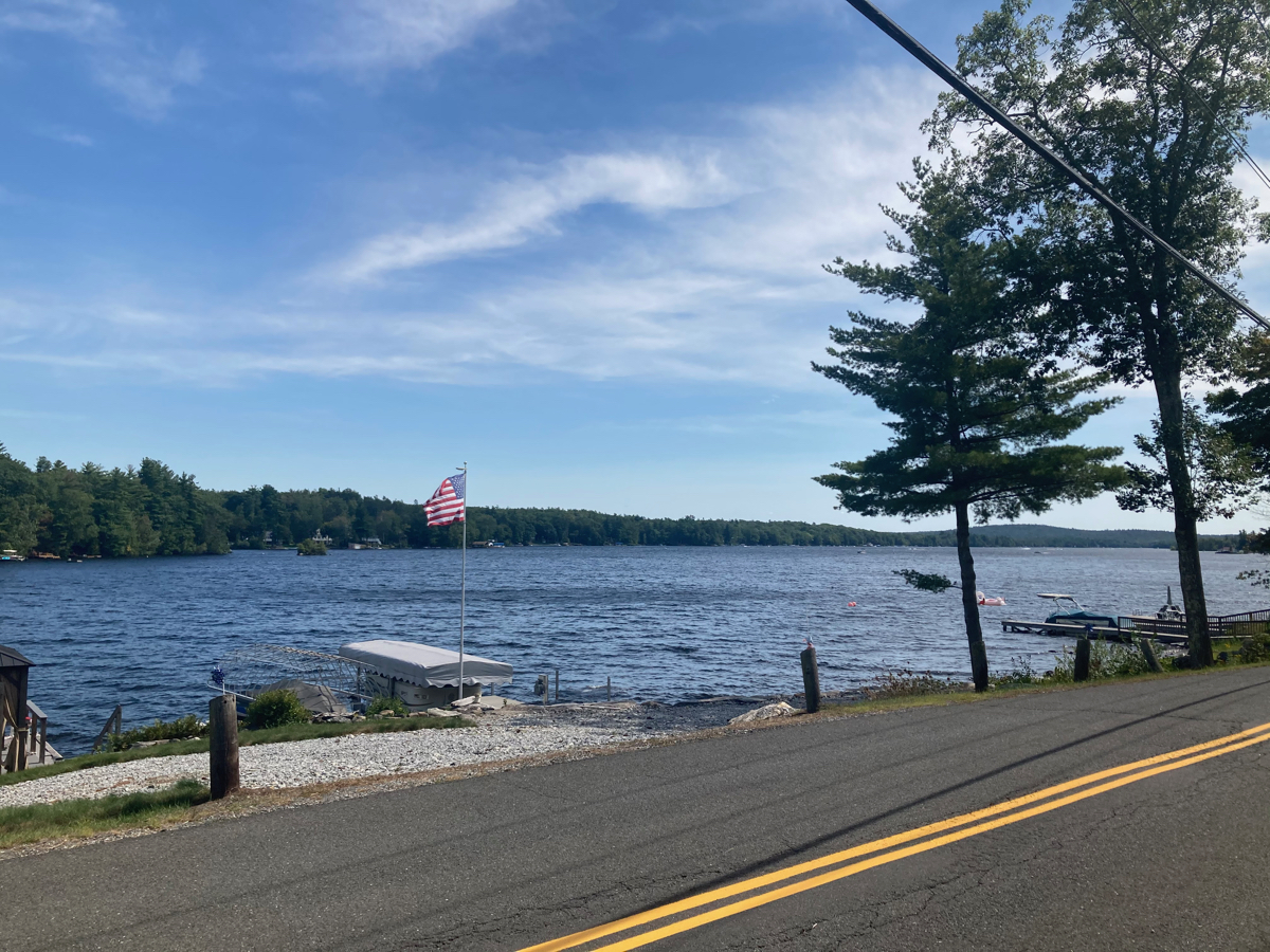
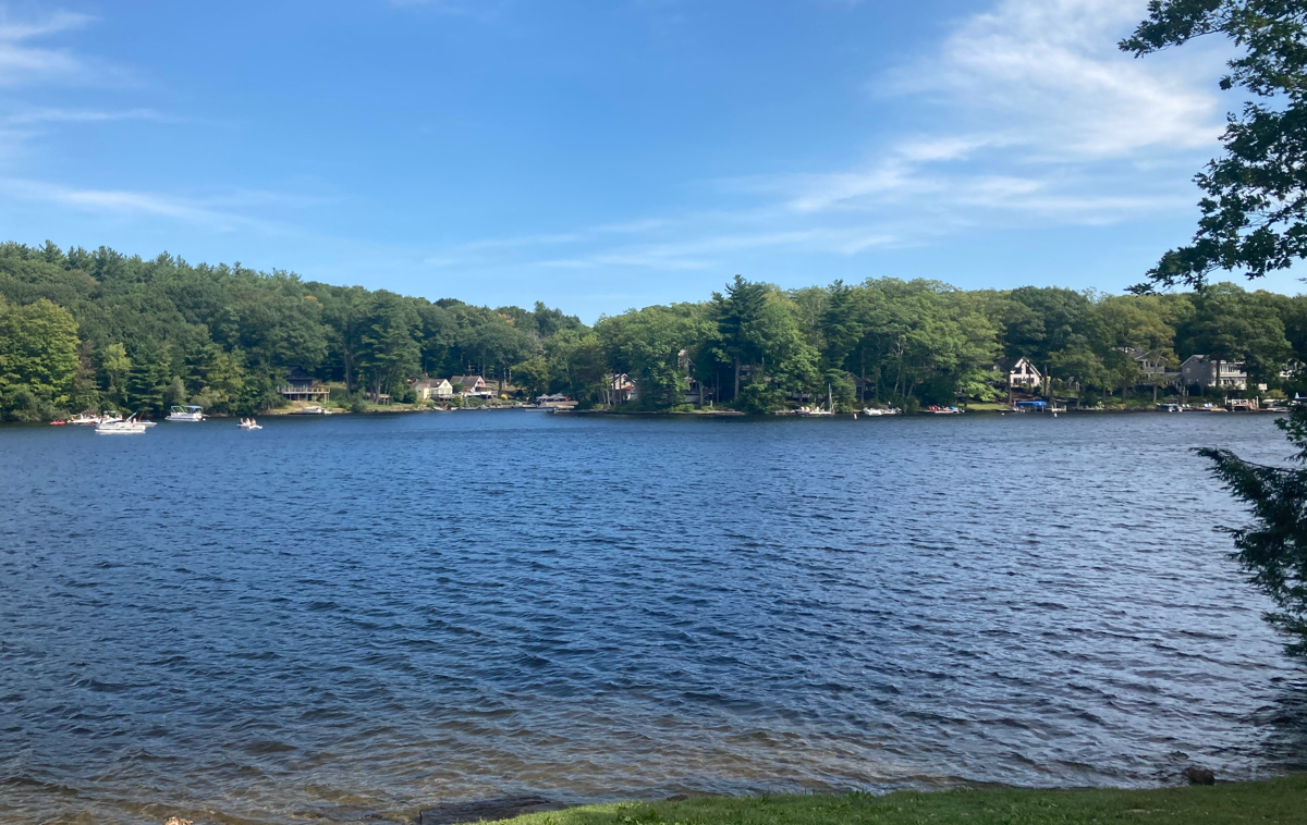
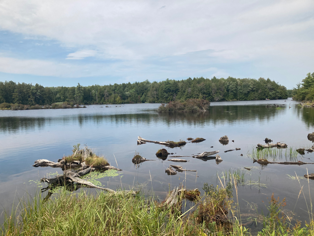
That body of water is called Blair Pond. Soon after this I entered the town of Otis, and soon got near the town center. This is when I left 23, and began to ride around the Otis Reservoir and Tolland State Forest. Here’s a view of the water on the north end of the reservoir:
I passed along the north side, then headed south on the western side of the reservoir. I was not close to the water the whole time, but I did come to a spot where the road went right along a bit of the water. There was a shady area with large rocks to sit on, so I stopped off there to eat lunch (which I had brought with me from home). Here’s the view from my lunch spot:
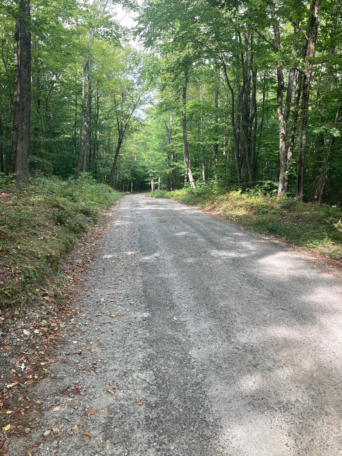
After eating, I continued south, heading away from the water. The route started with a quick climb, but then descended a bunch. Unfortunately, after the descent, the road I was on changed to a dirt road, and had a number of up and down parts. This is what it looked like for quite a while, heading south, then heading east along the south side of the reservoir:
I did get one more glimpse of the water from that road. This view is looking north:
I was looking forward to reaching the end of this road at a more main (north-south) road, which I assumed would be paved. It turns out I was wrong, that next road (called Schoolhouse Road) was also dirt and gravel. At least it had less climbing than the previous roads – even a small, gradual climb is a pain on a dirt road, given the lesser traction, and I had to apply the brakes a bunch on the downhill portions, for fear of losing control of the bike.
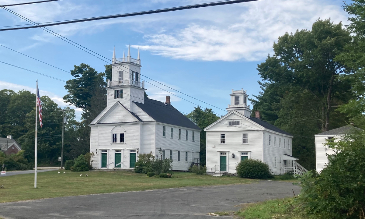
I did finally reach pavement again when I got to Route 57, near Tolland center (somewhere on the dirt roads I entered the town of Tolland). At this point it was considerably later in the afternoon that I’d expected, so I decided I needed to revise my route, and take the shortest path back to the car. I followed Route 57 east as previously planned, which had some nice downhill stretches, but also a few climbs that were tough after all the climbing I’d already done. I passed into the town of Granville, and came through the West Granville historic district. Here are some historic buildings, and the small white shapes on the front lawn of the church appeared to be chickens of some kind:
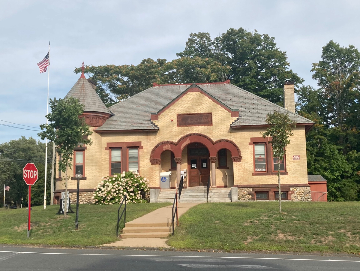
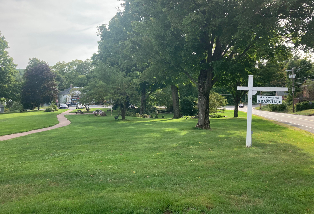
Not long after this point, the road started to be all downhill. I stopped off briefly in Granville center, and took pictures of the library and the town common:
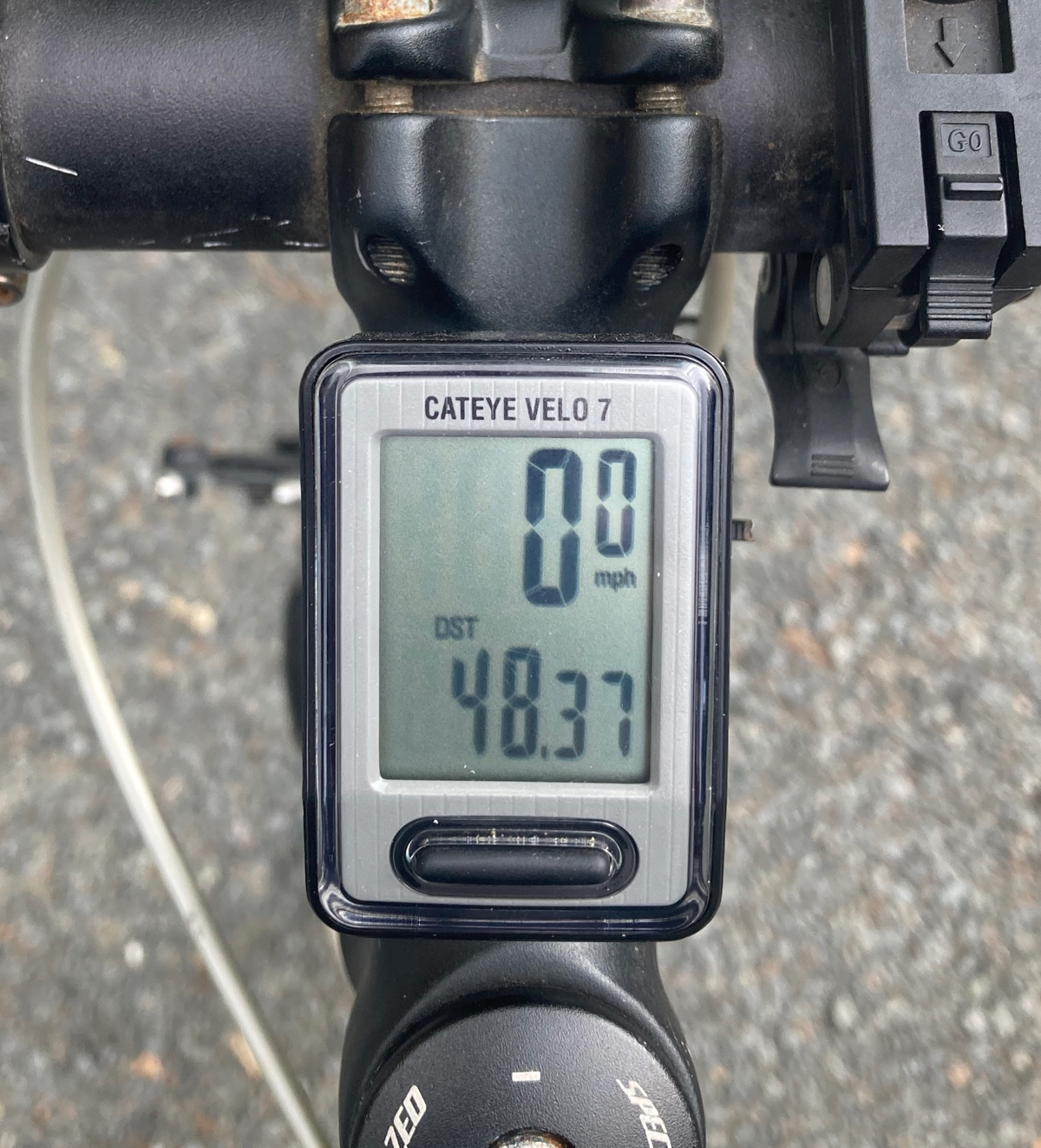
After this I continued east and downhill into the town of Southwick. The road leveled off and had a bit of up and down, before eventually bringing me back to the trail I had started on. I headed north on the trail, back into Westfield and to the car. I finished about the time I had originally expected to get back from the longer, 59-mile ride. Instead, I ended up going a bit over 48 miles. Here is the route that I actually rode:
So, this ride did not end up surpassing 50 miles, but at least I averaged more than 50 miles between the first two, so my total at this point is 105 miles for the month.
1 Comment
Pingback: Sean's Blog » Blog Archive » I Travel to Gorge, Myself