
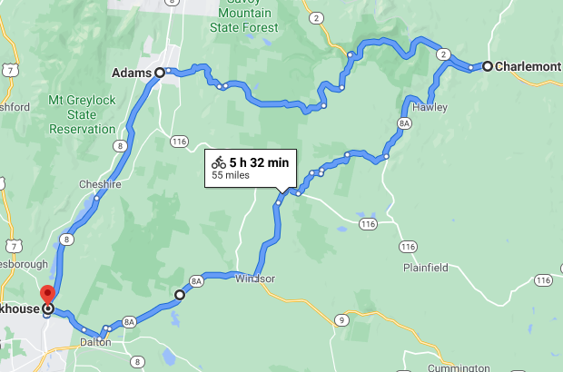
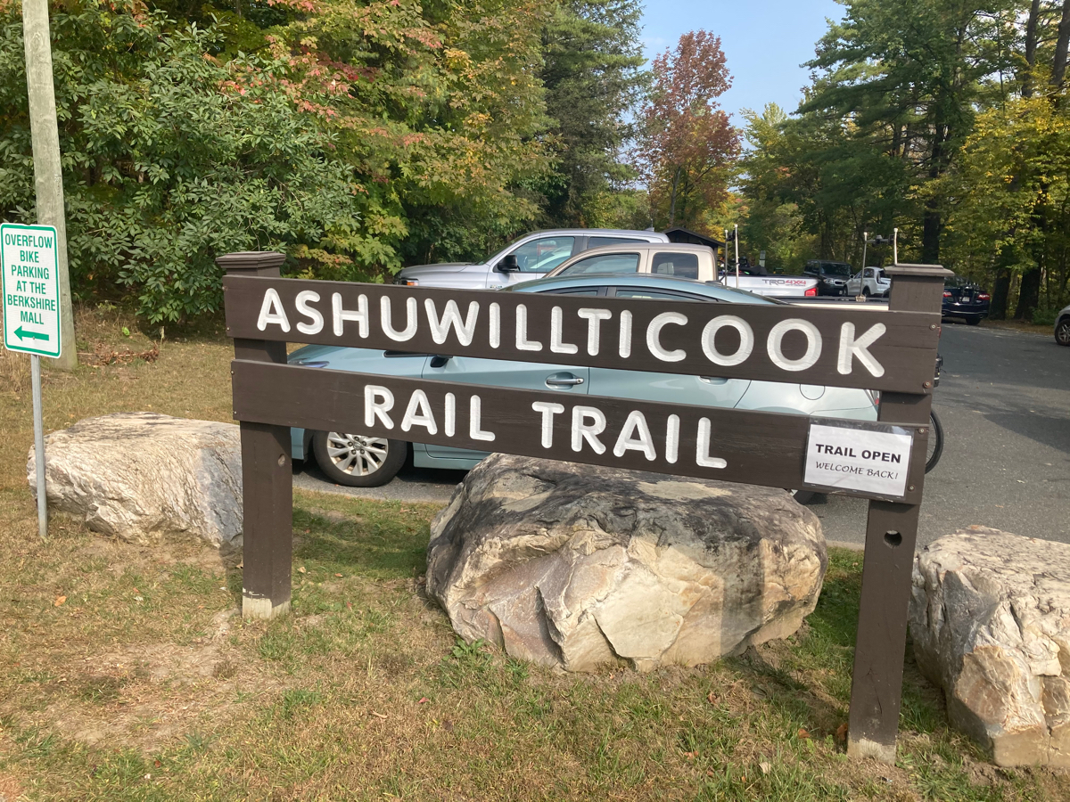
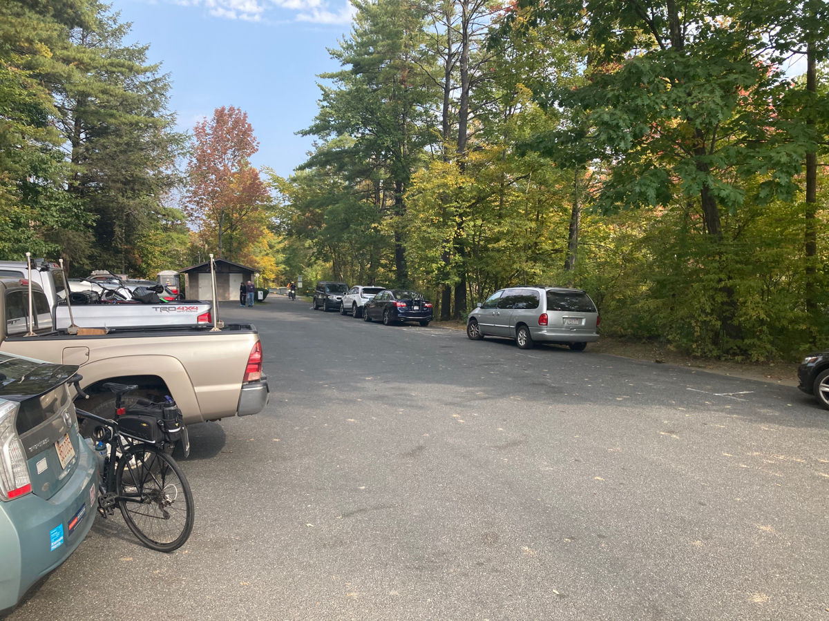
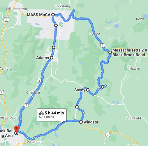
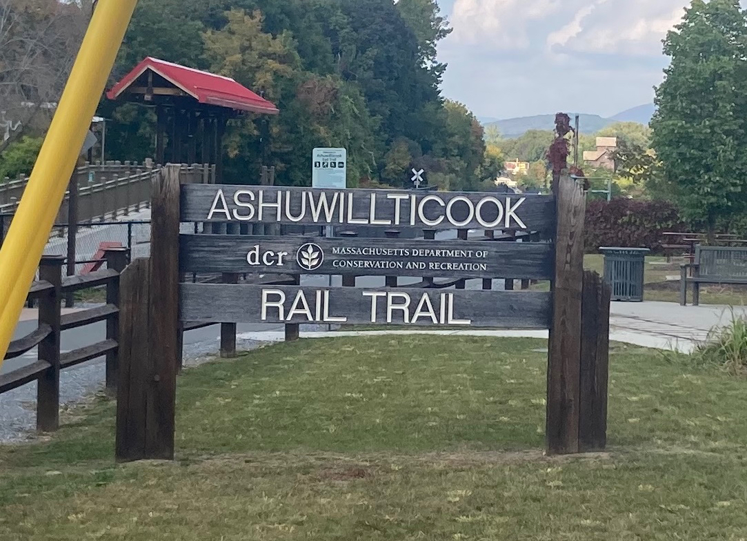
For my eighth and final ride this month, I drove out to the Berkshires to do a loop in the Northwestern corner of the state. Above is the map of the route I had planned (click images to embiggen). I parked in the town of Lanesborough, at the southern end of the Ashuwillticook Rail Trail. Here’s the sign at that end, and the parking lot (my car and bike are first on the left there):
My goal was to head northeast to the town of Charlemont, which I’ve never been to, and then to come back to the town of Adams, then head south on the trail back to the car.
I began by heading north on Route 8, and was going to be turning off pretty quickly, but I missed the right turn. I rode almost a mile north and realized that I should have passed the turn already. I backtracked, and discovered that what looked like a parking lot entrance was the side road I wanted – Gulf Road (there is a street sign, but it’s at least a dozen feet back from the main road).
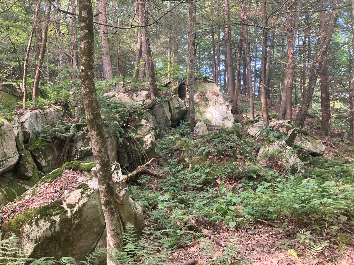
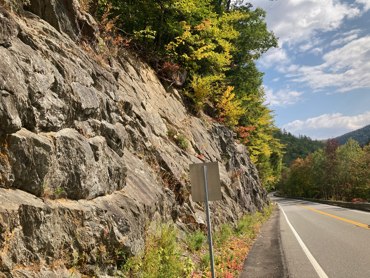
I headed east on Gulf, and it soon turned into a dirt road, but a pretty smooth one. It also started to climb, but I did not mind, as the scenery was very nice. Here’s some of the woods I passed through, where there were rocky hillsides on each side:
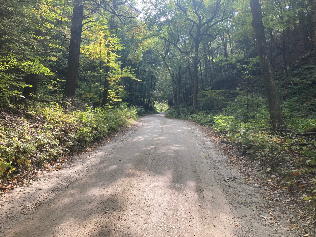
On this road, I passed into the town of Dalton, which was actually marked with a small sign. I also passed a couple of hikers coming onto the road, which is not too surprising, as the Appalachian Trail crosses this road in Dalton.
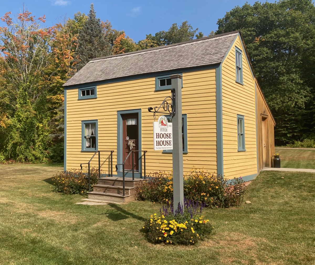
I headed downhill on the dirt for a bit, then the road became paved again, and soon headed out of the woods into a residential neighborhood. I saw this little historic house, which I looked up later on (here’s the info on it):
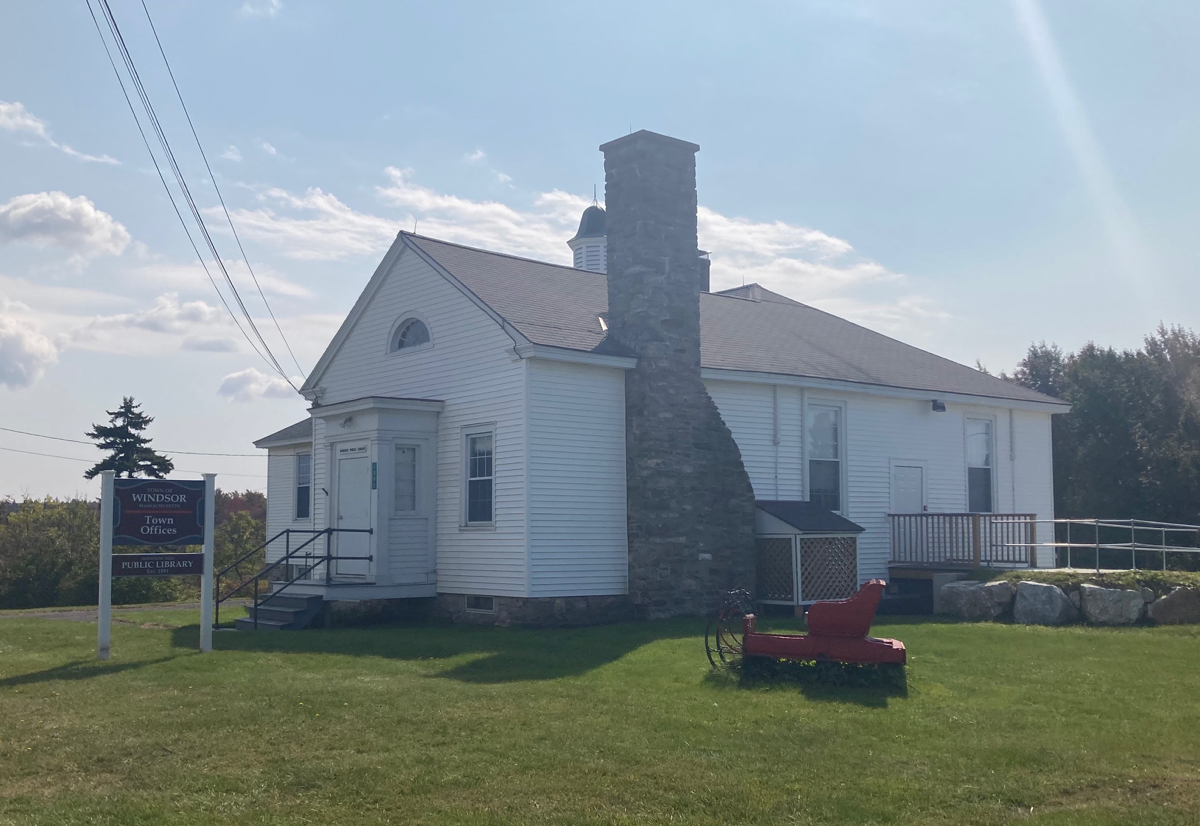
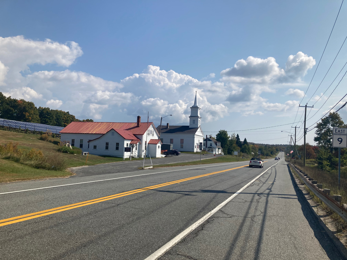
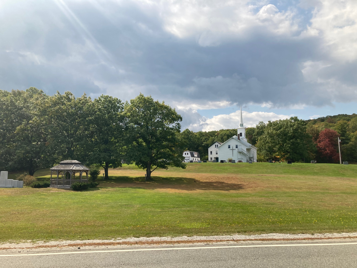
From here, I rode a few blocks east, then north, and came out onto Route 9. I followed 9 east into the town of Windsor, and then began to climb. I climbed for a good 3 miles in total, taking about half an hour or so, until the road leveled off in Windsor center. Here are some of the few buildings there:
Just past this stretch of Route 9, I turned north on a side road, which turned out to be another dirt road. I climbed a bit more on this road, and then began to head downhill, but also got pavement for most of the down hill run. However, I soon intersected route 8A, which runs north-south. This was a surprise, as I had expected to be riding parallel to 8A. I consulted the map app on my phone, and found that the original directions I was following (which I’d mapped on my laptop), were taking me on a road that did not seem to exist. So I had to adjust my route, and I went north on 8A, into the town of Savoy. This worked out okay for a bit, as I went a little uphill, but then got some nice downhill riding. Unfortunately, there were some bumps on the downhill, and it happened that my third water bottle, which was in a pocket on the back of my bike rack bag, bounced out twice when I hit some bumps. The first time it just got scraped up a bit, but the second time it hit the ground the cap popped off, and all the water had drained out by the time I recovered it. There went 1/3 of my water supply.
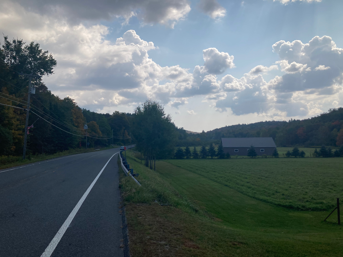
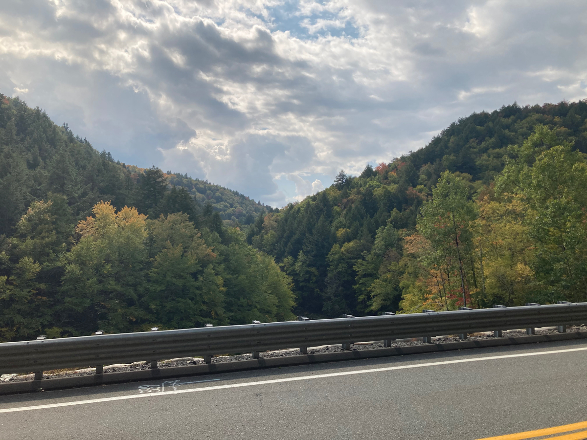
I soon reached Route 116, and headed east for a little bit, passing the point where I thought I’d be getting to 116 on my original route. Here’s a view along 116:
I reached my next turn, called Loop Road, and turned left to go further north. This route was as expected for a while – I had to climb some more, then the road turned east, and I took another turn to continue north. Just after that turn, the road forked, and as I remembered from the mapped route, I took the right fork (Hawley Rd.). Just after forking right, I headed downhill a bunch, and then came to a dead end. The road just went into a farm driveway, and there was no place to continue. I looked at a map on the phone again, and sure enough, the dead end was on there, but Google’s directions had claimed the road went through. This was especially frustrating given that I wasted 15 minutes or more climbing back up the hill to the fork.
I got back up there, and took the left fork (Chapel Rd.) intending to follow a different route east that I saw on the phone map app. However, the new road I was going to take (Barnard) had a “No Outlet” sign when I passed it. So, I did not go that way, even though the app claimed it was a through street. I checked the map and decided I should alter my course, as I was behind schedule at this point, after a few delays. If I kept heading north, I would actually intersect the part of my original route that headed back from Charlemont to Adams. So I thought about just turning onto Adams Road to go west, without the loop to Charlemont. However, this might make the whole trip too short, so I also contemplated continuing north up to Route 2, and then heading west. I did ride north and got to Adams road at the point where Chapel Rd. becomes Black Brook Road. I took one look at Adams Road and made my decision, because that road:
- Was a dirt road
- Headed uphill
- Had a surface of loose-looking gravel
- Had a big sign saying “Not maintained in winter”
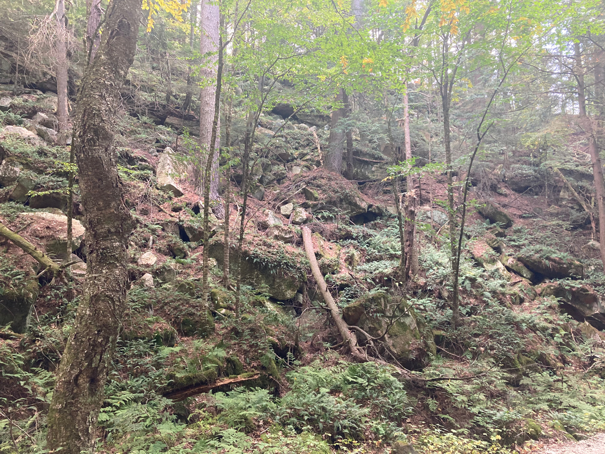
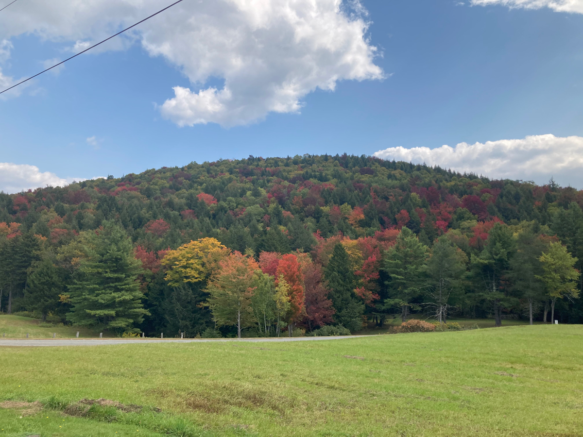
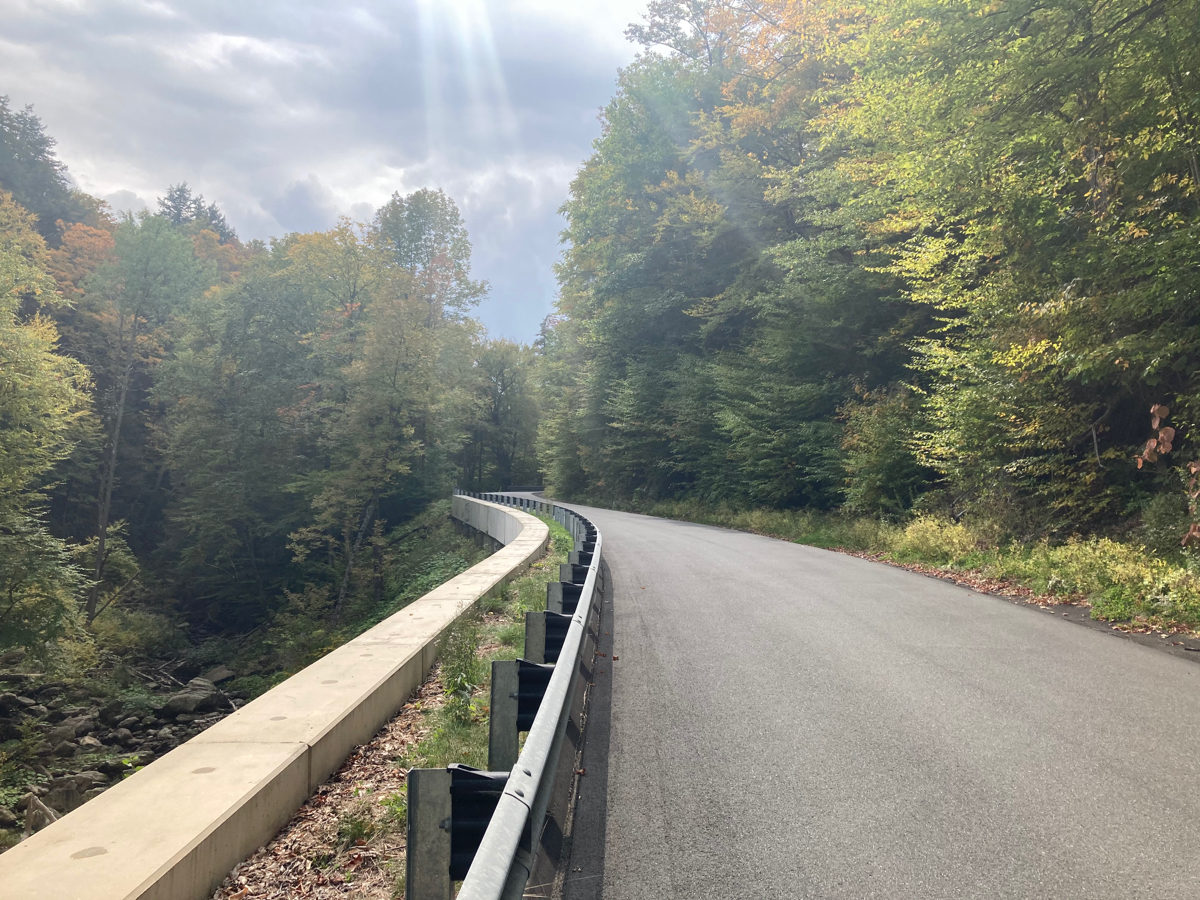
So I said a big “Nope!” and continued north. There was a bit of uphill riding on Black Brook Road, and then it started to head downhill, first through some slightly open countryside, but then becoming steeper and going through more of a wooded ravine. Here’s an early part of the downhill (note the fall colors already):
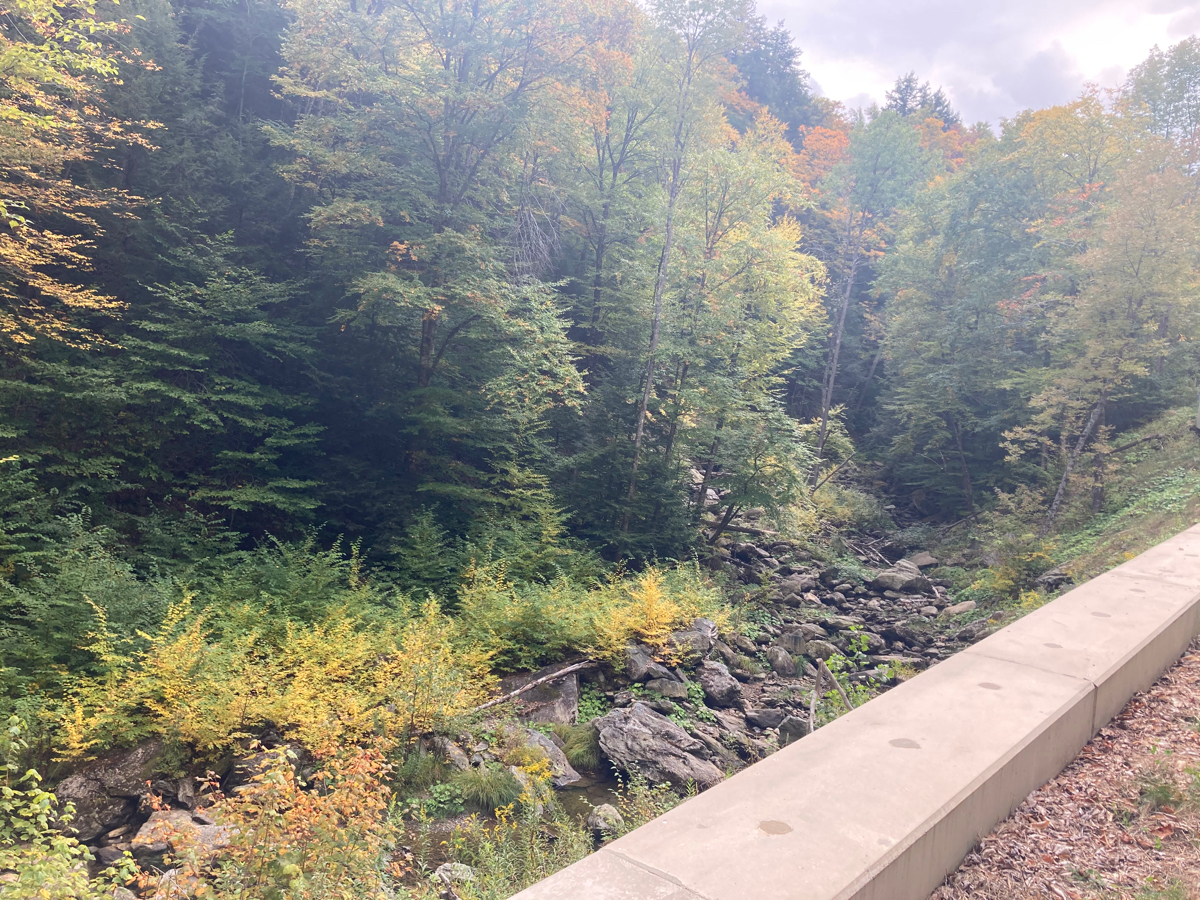
I stopped at one point on the steeper part where there was a view over the guardrail of Black Brook itself:
Here’s the view back up the road from there:
And here is the view downhill, ahead of me:
At the bottom of the hill, I got to Route 2, and turned to the west. I was still in Savoy, but about to cross another town line:
Here is what my new route was, now that I’d given up on Charlemont and was heading for North Adams:
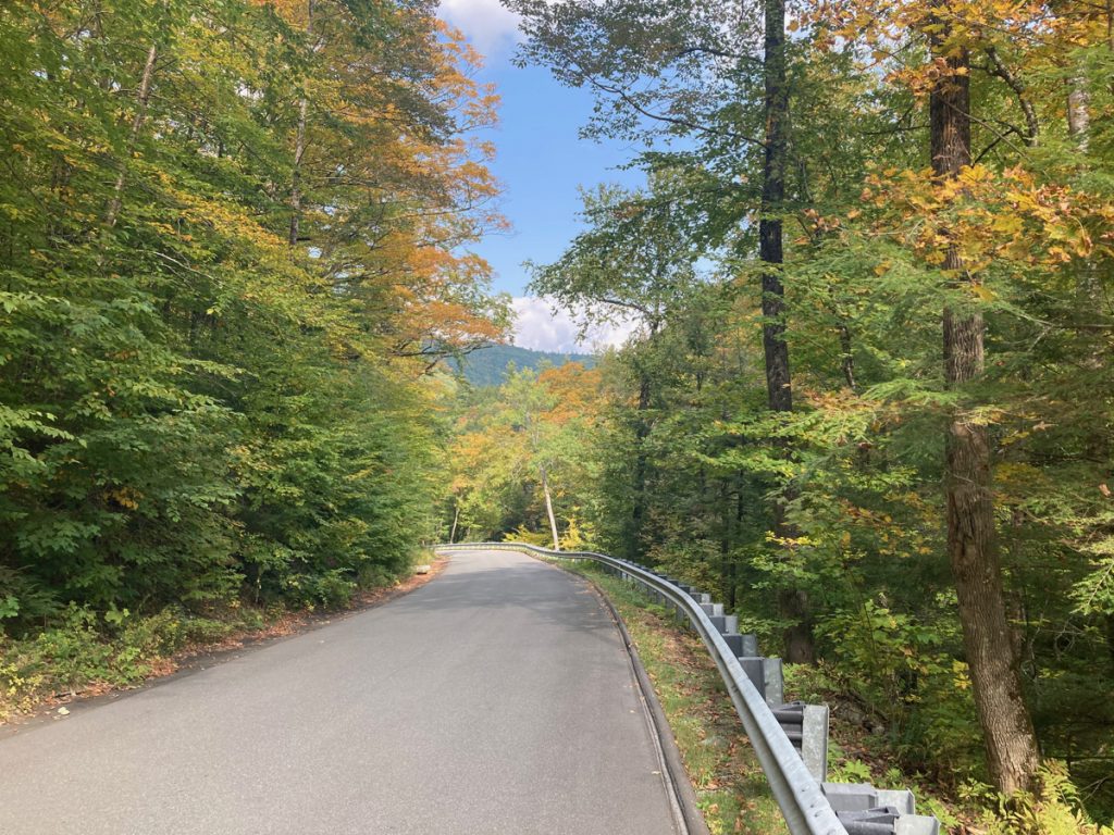
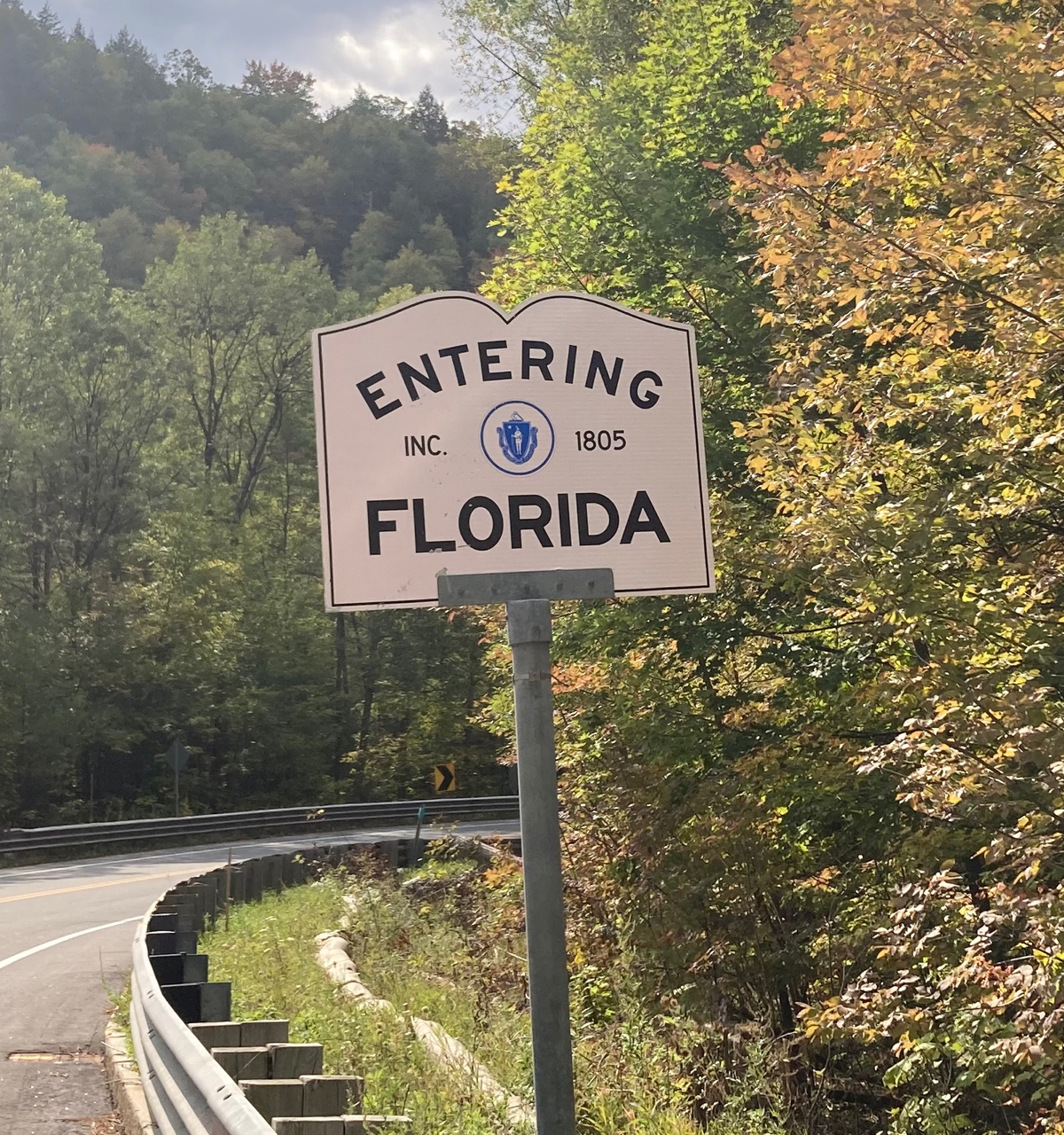
As I entered Florida, the road climbed, and it did so for a long time – easily as long a climb as I did on Route 9, and probably longer, though at least it was gradual all the way – on my original route, I would have gone downhill to Charlemont, then come to this point and climbed up Black Brook Rd, which is steeper than Route 2.
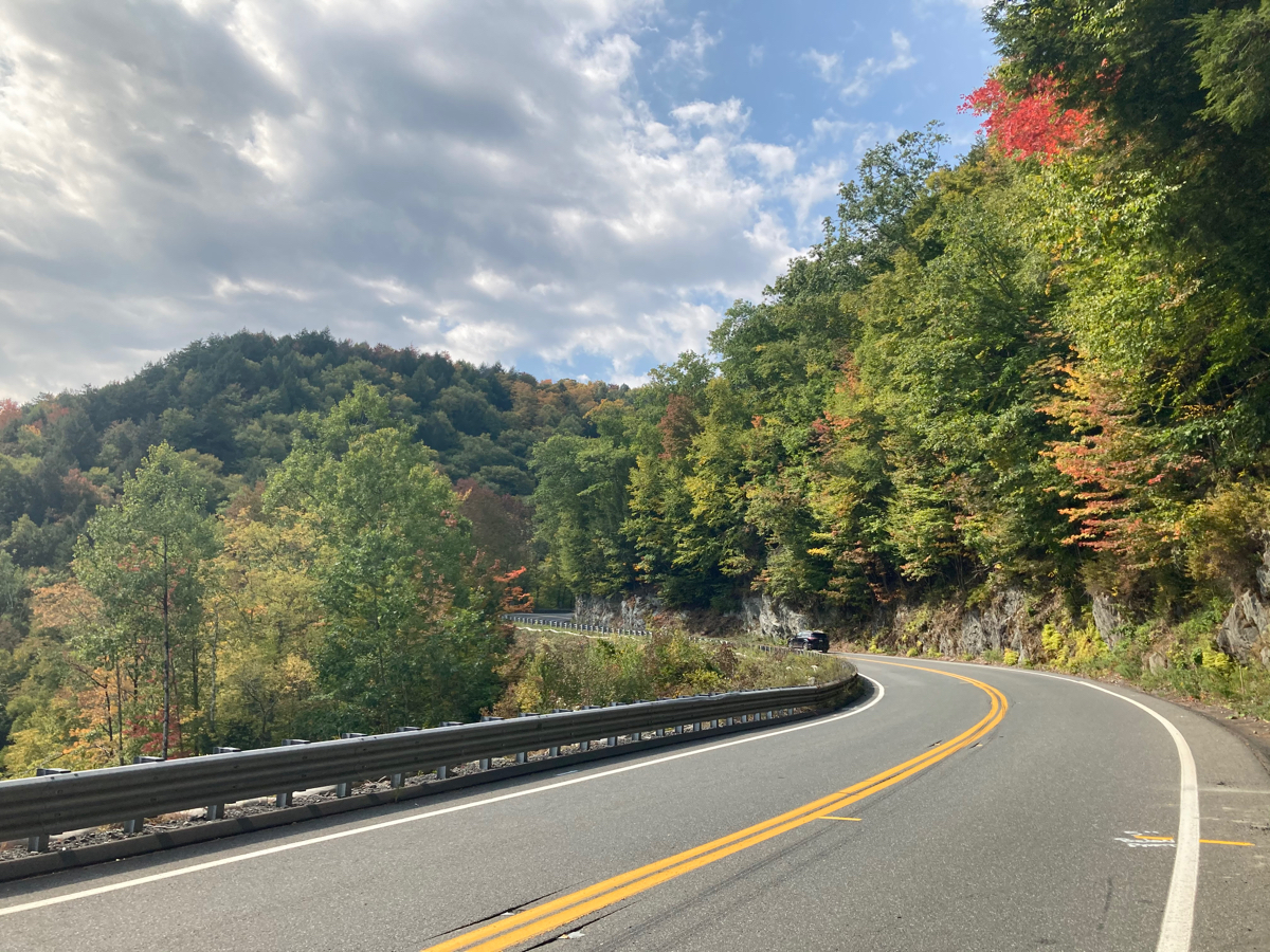
And at least the road is very scenic. Here is the scenery when I was just a little ways up:
After that spot, I saw signs for a construction area ahead, and warnings of a one-lane road. Sure enough, I came to a point where a police officer was holding back some cars while a bunch of traffic came the other way. Once he sent those few cars going west, he told me I could travel in the “construction” lane on the other side of the cones, as the construction equipment and workers were only at the far end of the area. So I continued riding nicely separated from traffic as I climbed some more. I was able to get into the regular lane near the end during a lull in traffic, in order to get past the actual road work. Beyond that, I still had a slight incline to ride up for a while, and then got to what might be the center of town (or near the center):
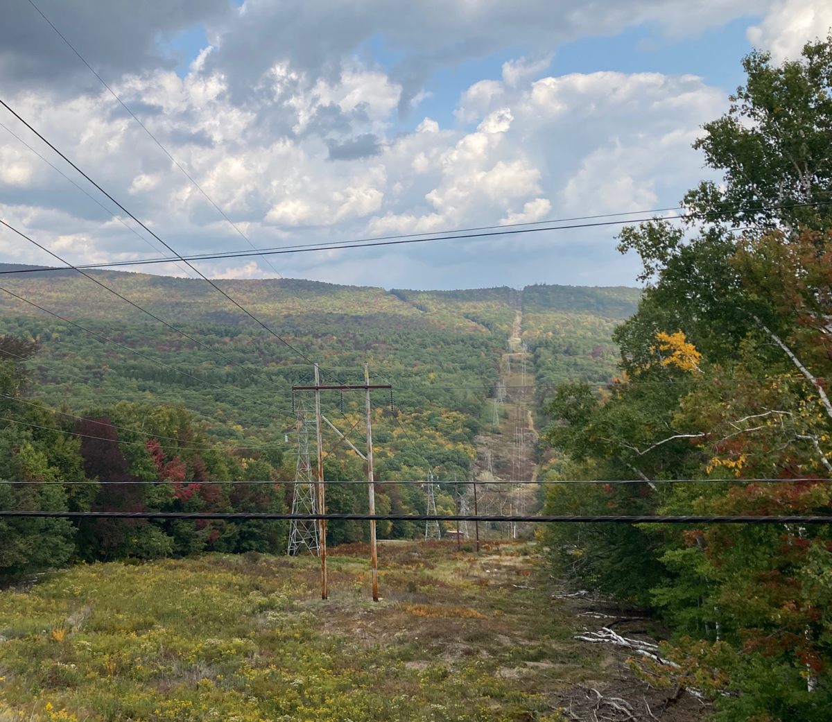
I then had mostly level riding for a while, and had some nice views to the north, looking out over lower ground and other hills:
There were still a few sections of road where I needed to climb, and at what I think was the highest point on Route 2, there was this elk statue:
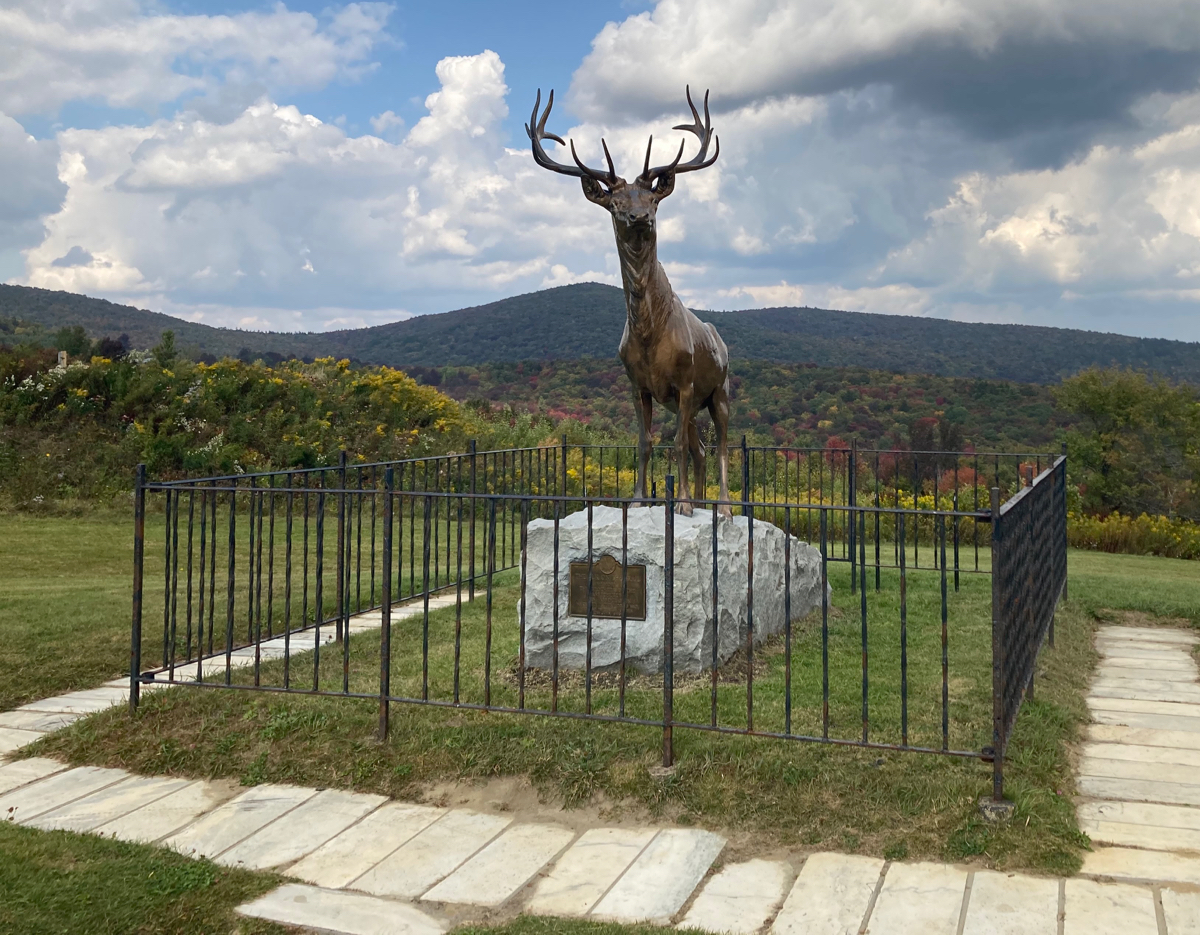
This is “The Elk on the Trail“, a World War I monument that was put in place almost a century ago.
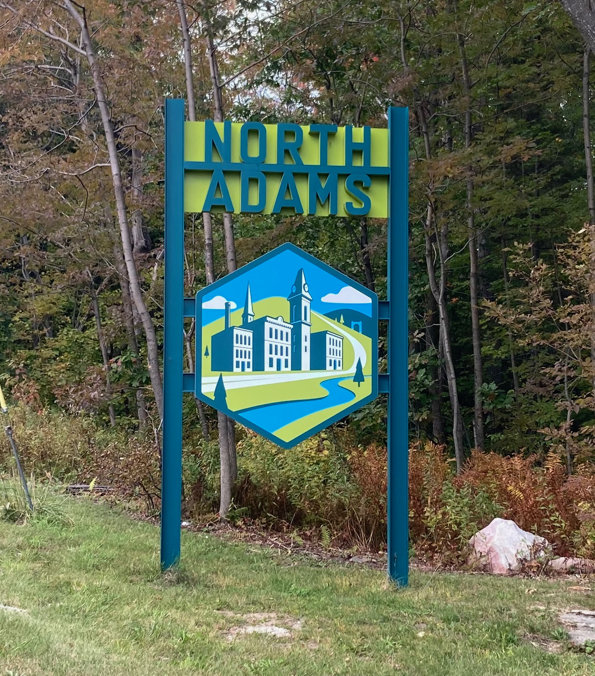
There was a bit of downhill after that, and then one final little bit of climbing, as I came to the city line of North Adams, where this sign greeted me:
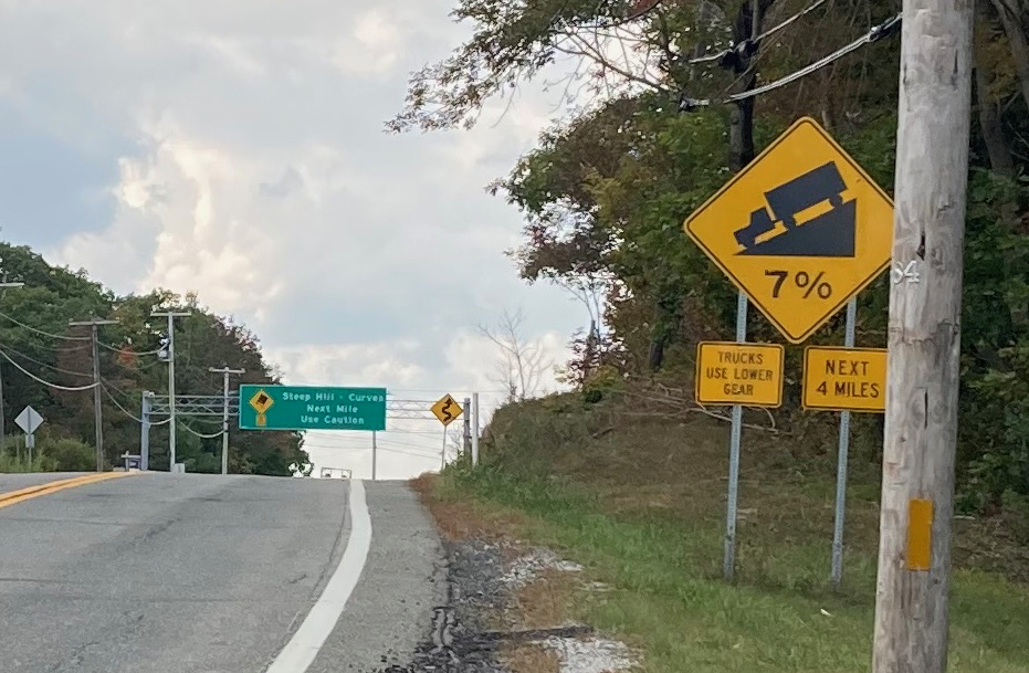
Just beyond that are signs warning of the impending downhill run:
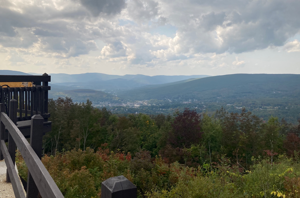
Just past that green sign warning of the steep hill is this view of the valley below, including downtown North Adams:
That view is right by a small store, where the proprietor was selling stuff from a table on the porch, in front of the entrance, presumably to avoid having people come inside the building. I was hot and thirsty, and had lost some of my water supply back in Savoy, so I bought a cold pineapple soda, as well as a bottle of water.
From here, the road turned briefly north as it sloped down, but only for 1000 feet, and then it had a hairpin turn to go south for another thousand feet, before heading west again. I had to go slowly until I was around the sharp turn, and then I could lay off the brakes and get going fast into town. Incidentally, the tip of that hairpin turn sticks a bit into the town of Clarksburg, so one is in that town for a few dozen feet of road.
In the downtown area, I passed by Mass MoCA, and turned to head south on Route 8. That’s a pretty easy ride, as it’s almost completely level, and there is a nice wide bike lane on the road.
It was not too long before I got into the town of Adams, and in that downtown area I came to the Ashuwillticook trail, just a bit south of its northern end.
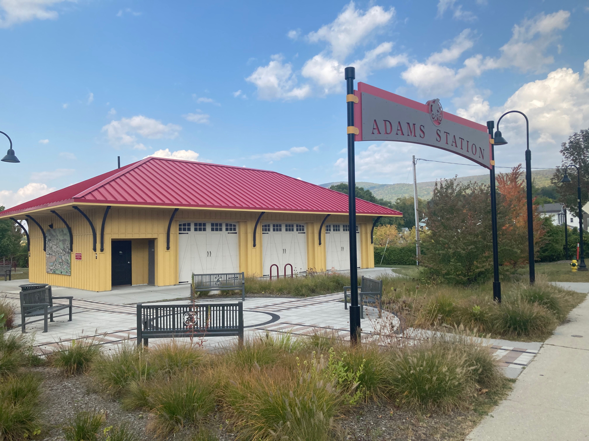
This old station building stands right by the trail:
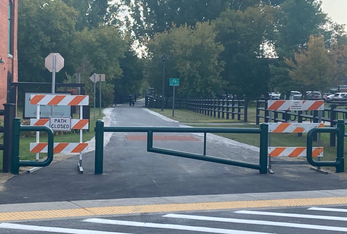
Looking south, I was surprised to see signs indicating that the trail was closed:
I rode south on a street parallel to the trail for a bit, hoping that it would only be a small section that was closed. I saw some other cyclists who were stationary on the trail near a restaurant, and so I asked if they knew how much of the trail was closed and why. The northern section of the trail was apparently being resurfaced, and at that point there was a nice smooth, rideable surface. Though the work was not quite finished, there were no workers present at that time of the day (about 3:30pm), and so many people were using the trail.
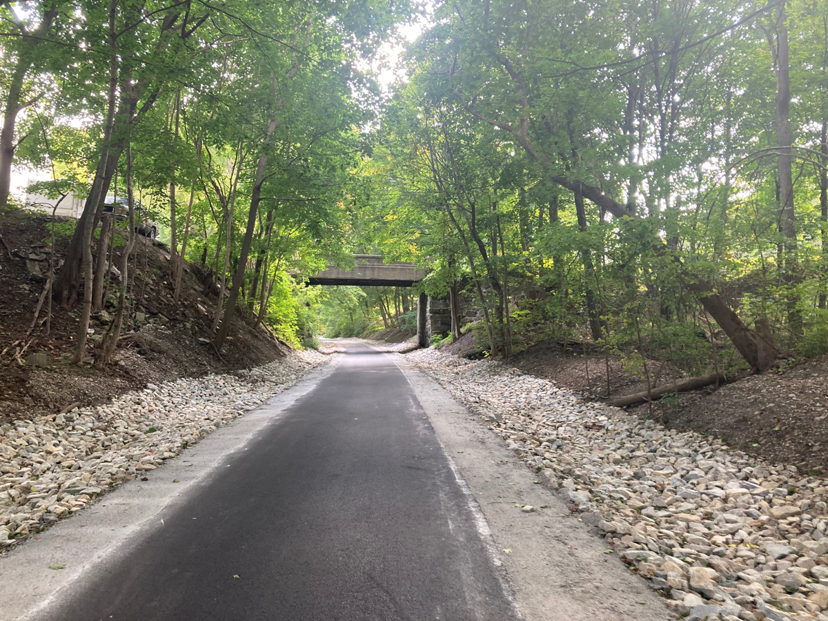
I went ahead and rode south on the trail. Here’s a section that is still officially under construction, just a little south of downtown Adams:
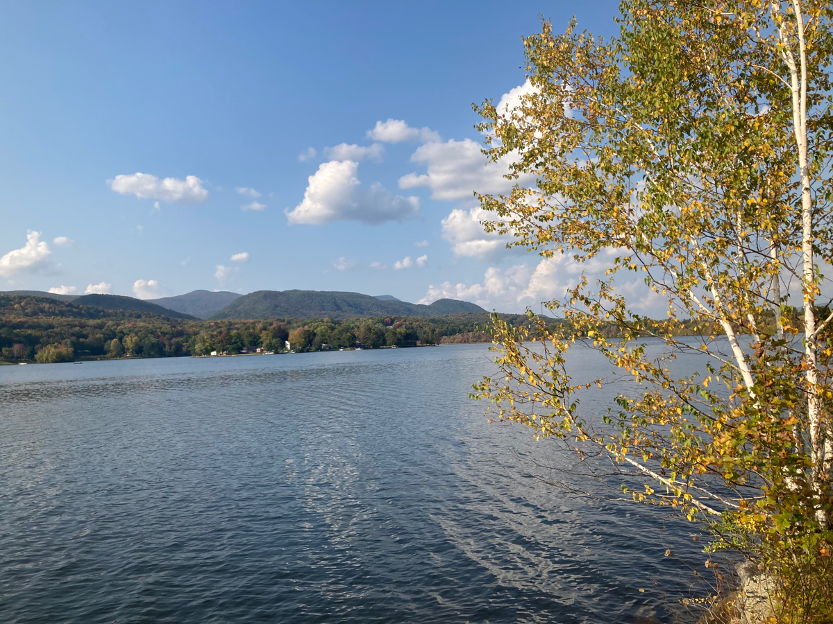
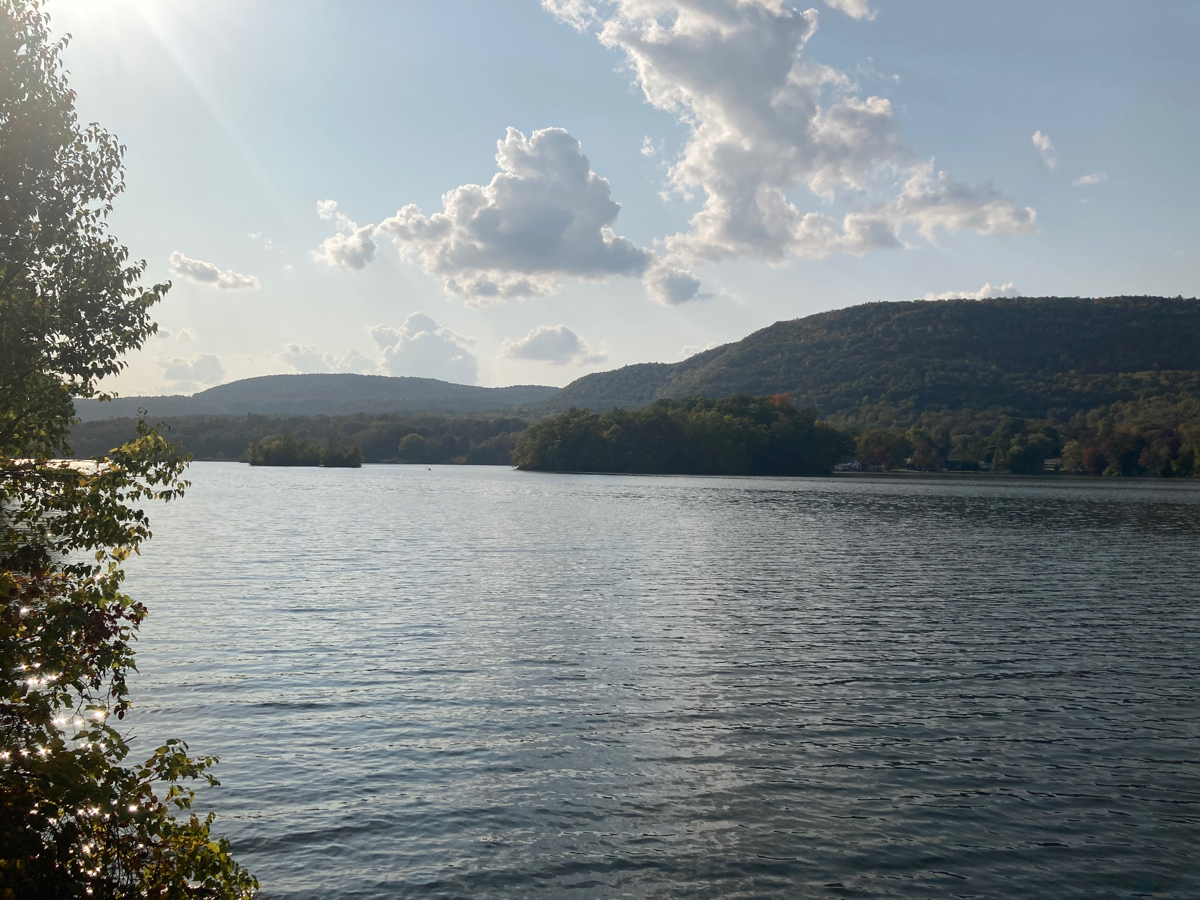
My legs were getting tired, and I was feeling saddle-sore, but I pushed on south through the rest of Adams, and then through the town of Cheshire, where the trail runs for a long distance at the side of the Cheshire reservoir:
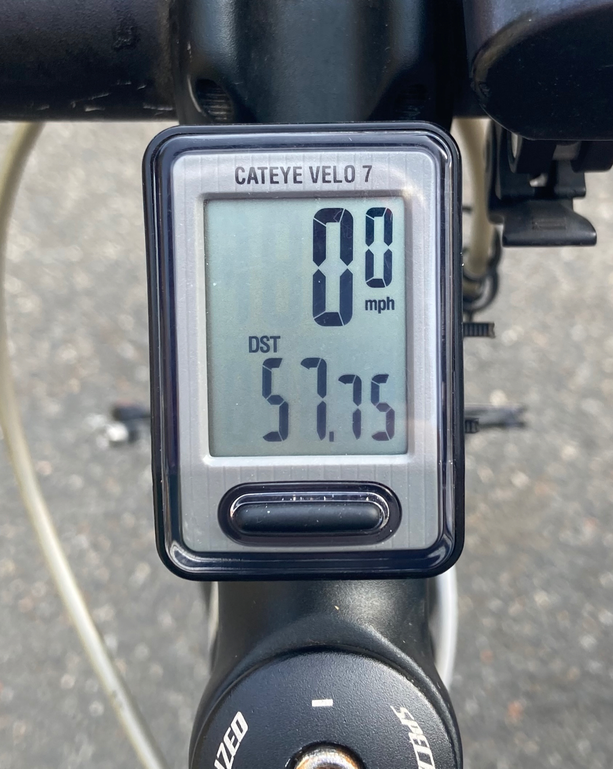
Eventually I got through Cheshire, and rode a couple more miles through Lanesborough, until I reached the southern end of the trail, and my car. My total time on the modified ride was about 6.25 hours, and the distance I traveled (including wrong turns and backtracks) was 57.75 miles.
This concluded my riding in September, and I ended up going a grand total of 445 miles over my 8 rides. However, I did promise a bonus ride in October, and as my fundraising goal was met, I will be doing that ride soon. Stay tuned for a post about it.