
On Saturday I went for one last long training ride. This time I rode from Northampton up to Greenfield, and then came back by way of Montague. The total distance is about 46 miles. The big advantage of this route over previous ones I rode is that it has virtually no hills, so I was able to focus my energy on distance.
Mass highways 5 and 10 run together on the same road from Noho to Greenfield, and seem to be relatively low in traffic (presumably because any traffic that isn’t local would be on I-91). This makes the route pretty good for biking, despite the shoulders being small to non-existent.
Getting out of Northampton is pretty quick, and one first passes through the town of Hatfield. No, there is no neighboring town of McCoy that they’re at war with. Hatfield is fairly rural – at least along this road, you don’t encounter much beyond farms and residences. I saw, but didn’t take pictures of, lots of pumpkins. I find it kind of odd that people would buy jack o’ lantern pumpkins now, as I would think them fairly likely to rot before Halloween, even if you don’t cut them open right away.
After Hatfield I passed through Whately, which is still quite rural, though there are a few more businesses, including some high tech ones. I passed by the local office of this company, with whom I applied for a job a couple years ago.
Once out of Whately, one is in Deerfield, which is longer North to South than either of the previous towns, and has more traffic, as it has Tourist AttractionsTM. The first of these that one passes is Yankee Candle Village, a place whose appeal I confess to not understanding. Anyone who has been there can feel free to enlighten me in the comments (perhaps it helps to be interested in candles…).
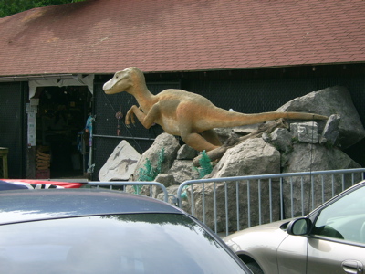
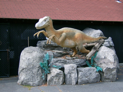
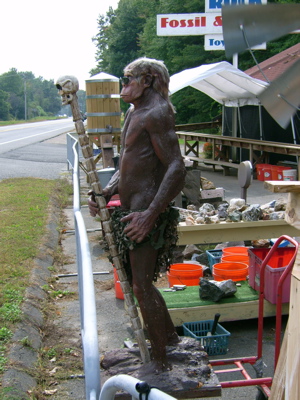
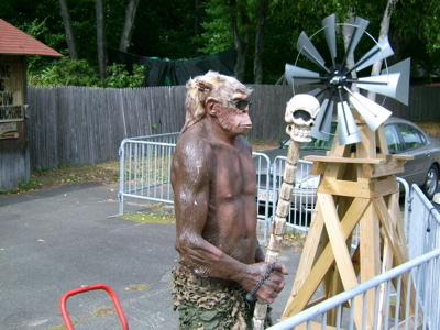
I do understand the appeal of this place, though:
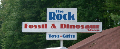
I didn’t take the time to go in, but took pics of two exterior denizens:
I also passed Magic Wings, which I’d heard of, and would like to check out sometime, and Dr. Spooky’s Animal Museum, which I’m undecided about (it’s like a haunted house meets a science museum, I guess).
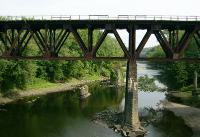
Eventually, I reached the Deerfield River, which is the border between Deerfield and Greenfield. Here’s a view from the bridge, looking at a train bridge and some old bridge supports, as the river flows East toward the Connecticut River:
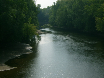
and here is the view upriver to the West:
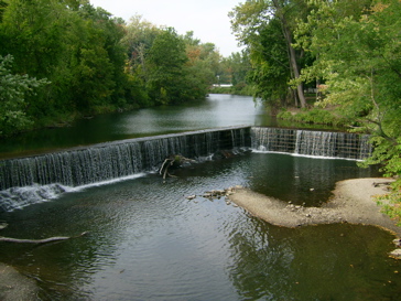
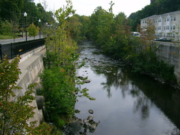
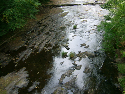
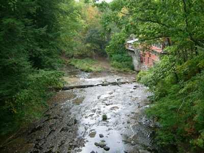
As I rode toward downtown Greenfield, the road passed along another waterway, the Green River. This view is looking North (upriver):
Then these pics are looking South, along the river and the sort of riverwalk they have:

Once downtown, I took a break to have some lunch and do a little CD shopping (didn’t buy anything). I started heading South on 5/10 again, but turned East just before the Deerfield River. After a short bit I came to the Connecticut River, and crossed over the rather beat-up bridge connecting Greenfield with Montague. Here is a shot of the bridge:

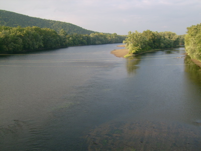
You probably can’t tell how rough the road surface is. Let it suffice to say that it isn’t pleasant for biking. There is a nice view of the river here, though. This is looking South from the bridge:
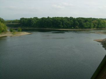
The Connecticut flows off to the left there, and on the right is the mouth of the Deerfield. That train bridge visible on the left seems to be in the process of becoming a bike bridge, as I saw when I rode by it a few minutes later.
Once I had crossed the Connecticut, I headed South, and passed the Montague water treatment plant. Because of the smell surrounding the place, I tried to move past there quickly, and so didn’t stop to investigate the seeming bike path and bridge (which appeared to be blocked off, anyway). I headed on down to Montague center, to visit the Book Mill. It’s a neat store, being in an old mill building right on a river.
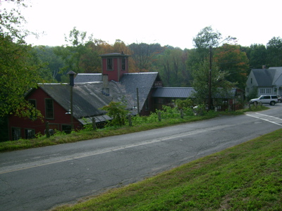
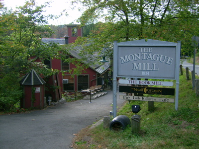
I hung out there for a good hour, getting another nice rest before the big ride home. As I was getting ready to leave, I took some pictures of the Sawmill River itself (the Book Mill building is on the right in the second photo):
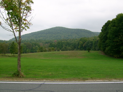
From there I headed South into the town of Sunderland, where I paused at one point to photograph Mt. Toby, which I’d like to hike sometime:
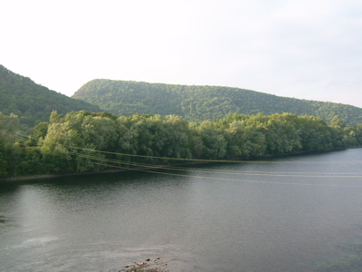
Once I got to Route 116 in the center of Town, I turned and headed West back across the Connecticut. Here’s a view North (upriver) from that bridge:
On the far (Western) side of the river you can see the 2 peaks of the Mt. Sugarloaf reservation, which I also want to hike. This is North Sugarloaf:
and this is South Sugarloaf:
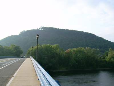
Not to be confused with the famous ski resort in Maine.
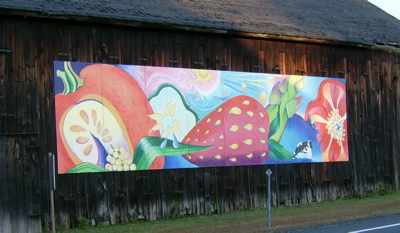
A bit past the mountains, I rejoined routes 5/10, and headed South toward Noho. On the way back through Hatfield, I got a picture of this mural on the side of a barn:
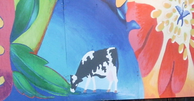
That cow has a lot to feast on, assuming that she likes fruit:
I arrived home about 6.5 hours after I’d left. Pretty good time considering that at least 2 hours of the outing were spent resting. Even though I expect the actual ride to be hillier, I think the 50 miles will be quite doable in the 7.5 hours expected.
In other words, I believe I’m ready for the big ride, and not too soon, as it’s coming up in 5 days. Stay tuned for more updates, and some live posting from the ride on Saturday.
2 Comments;
The mere words “Yankee Candle” are enough to give me a headache. Actually spending time around them — ie, in a Yankee Candle Store — gives me a migraine, and sometimes sets off my asthma, as I’m sensitive to the chemicals.
So I can’t help you, except perhaps in the opposite direction.
Pingback: Sean’s Blog » Blog Archive » Training: Turning or Falling