
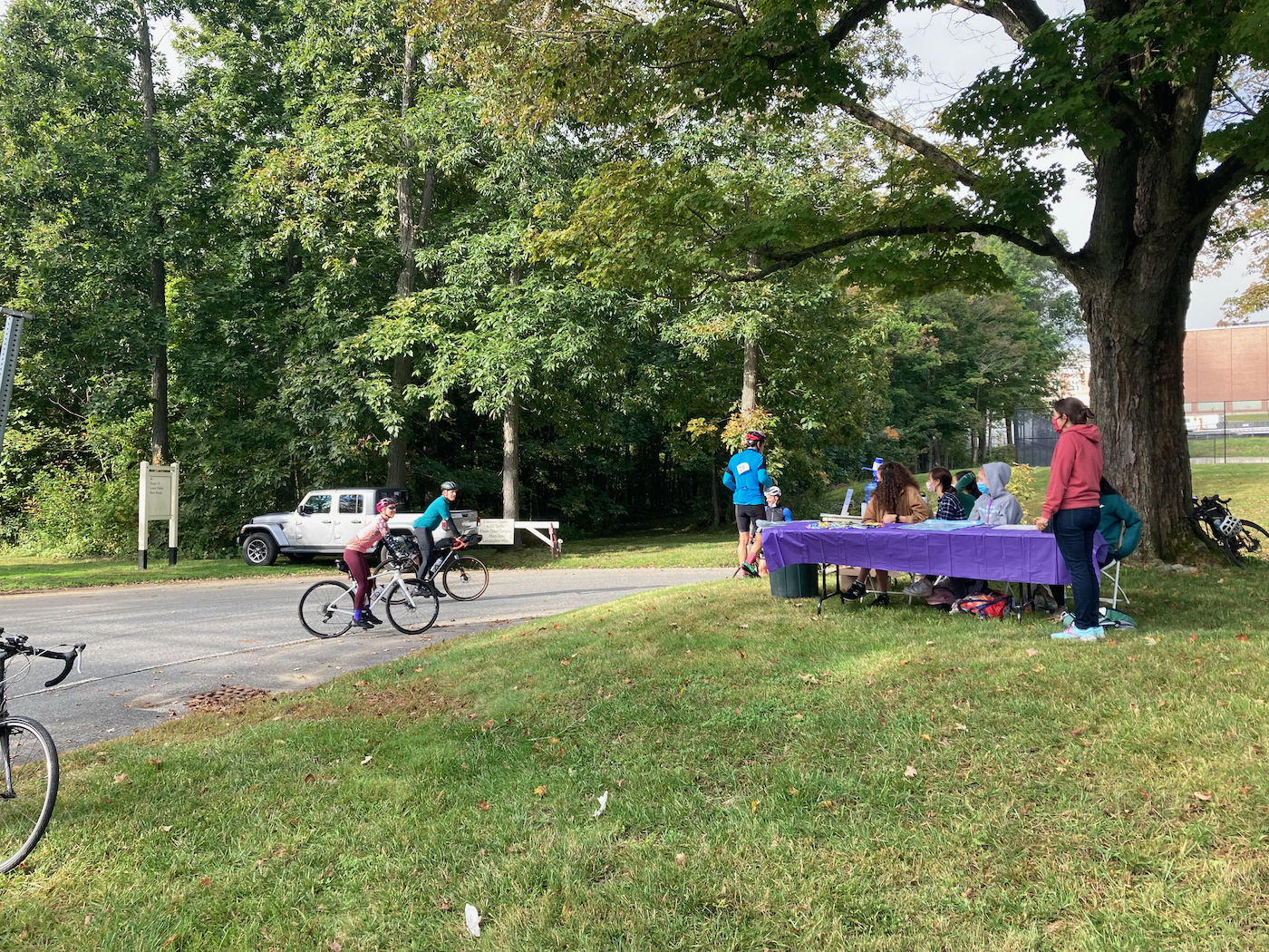
Here’s the detailed story of my Will Bike 4 Food ride this past Sunday. I arrived later than I had in past years – getting there with my bike at 6:45 or so instead of 6:30. This was not a problem, though, as they were not offering a big spread of food this year (because of COVID restrictions), so I had eaten breakfast at home. Therefore I had no need to eat when I got there – I just checked in, pinned on the bib they gave me (#18), and prepared to start riding. Here’s the registration, etc. tent (click on pictures to see full-size version):

The ride went north from Hatfield center, and as I got into farmland, I could hear birds making a lot of noise in a couple of places. As I continued north, I passed a few other cyclists, and was passed by more. The route went through Whately, and up into Deerfield (on River Rd.). Once I got into Deerfield, there was a bunch of fog. At one point, in the fog off the side of the road, I could see the silhouette of a deer, in a field. Very appropriate. In the same section of road I also saw a flock of wild turkeys.
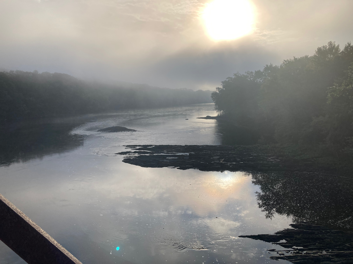
In the northern part of town, I headed onto the beginning of the rail trail, and went across the Connecticut River into Montague. I couldn’t resist stopping on the bridge to take a picture. This is facing south, downriver:
The trail took me through the northern part of Montague, into the Turners Falls section of town. This is the same trail I rode along, in the opposite direction, just over a week prior. The route followed the trail almost to its eastern end, and then I rode up onto the main road and over the CT River again into the town of Gill. I crossed Route 2 and started climbing Main Road, and then turned onto Mountain Road, which climbs even more. On this climb I got passed by more riders, but was able to get to the top of the hill without stopping.
Just before heading downhill, I did stop briefly to take a picture of a sculpture near someone’s driveway:

The artist may live in that house – who knows?
From there it was downhill for a while, down to Main Rd. again, and then some more downhill to the town center. I had been heading northeast, but now the road curved north and went up and down a bit. I soon came to the Northfield Mount Hermon School, and the first rest stop, which was staffed by students and a teacher from the school:
I got a granola bar and some candy there, and of course topped off my water. Leaving there I continued north, then headed just a bit west on Route 10, and then north again through the town of Northfield on Route 142. This highway goes up into Vermont, crossing the state line just after mile 31 of the ride.
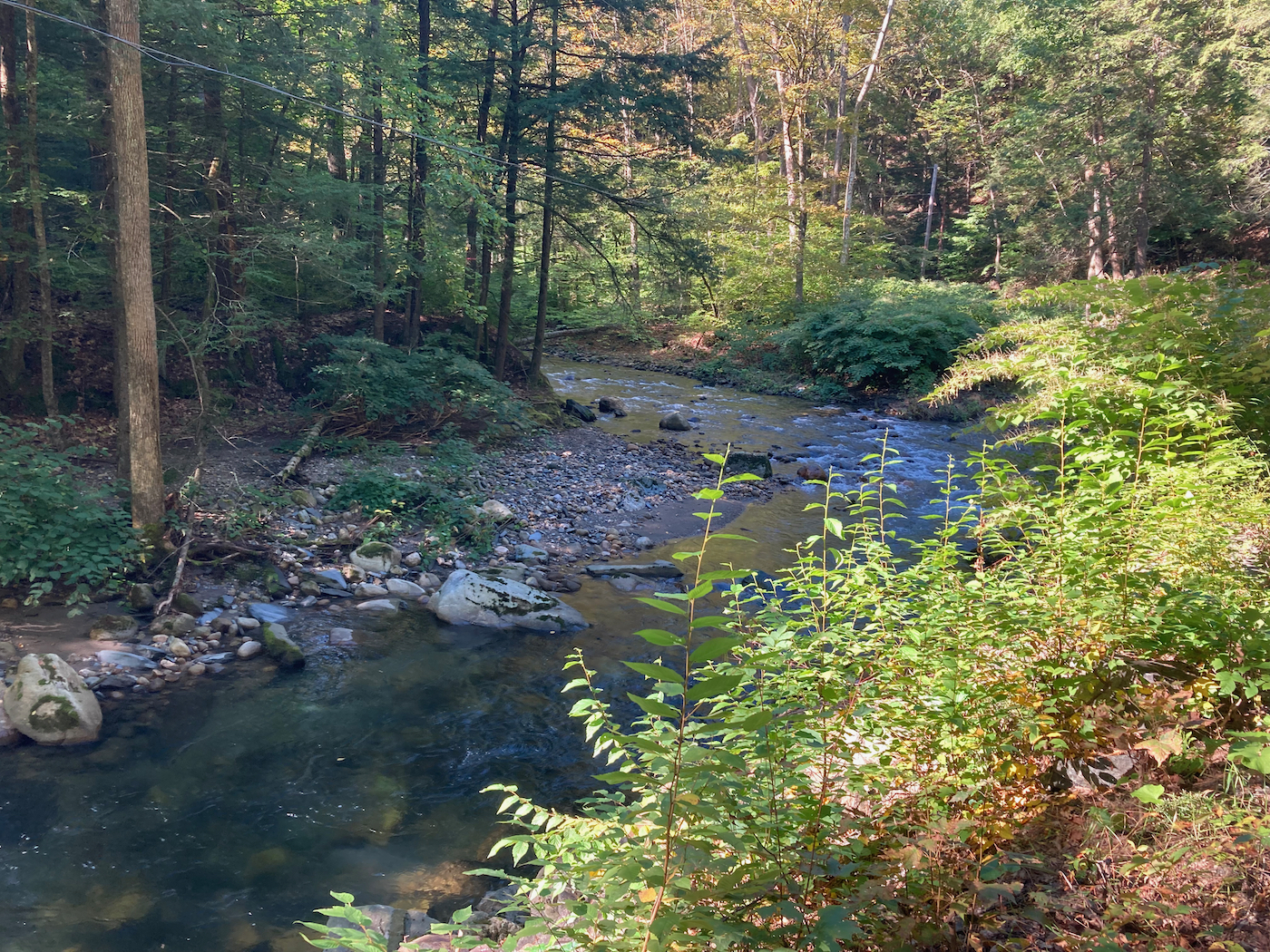
In Vernon, VT, I went through more rural area, eventually passing through the town center, and with some small, rolling hills. At almost mile 40, the route turned west and climbed up the dirt road Broad Brook Road. It is so named because it runs along Broad Brook, which you can see from many points on the road:
I kept climbing and the road became paved around the town line of Guilford. Soon after that I came to Route 5, and I did a quick jog onto another road where the second rest stop was located, at the Guilford fire station. The day was warming up at this point, so I was able to remove a layer and go with short sleeves. After that stop, I rode southwest for a bit and then due south. This involved more upward riding than down, and the route entered Massachusetts again around 48 miles. Just a hair before I crossed the state line, I saw what at first I thought was a pair of cats crossing the road, but as I got close I saw they were raccoons. They looked full grown, but acted like they were fairly young. They were kind of meandering across the road, but when I got close they got spooked and quickly ran to the far side and off into tall grass. I barely had time to contemplate taking a picture, but no time to get my phone out.
There was a bit of downhill just after I entered Leyden, MA, but then some more climbing. The route soon turned sharply west and went up a short but steep climb to Leyden center. I stopped to rest for a bit after making that climb. And this was about the 50.5 mile point – I was halfway done.
I’ve photographed it in the past, but I took another picture of this sign that someone has in front of their house, adjacent to the town hall:

After this there was a quick steep downhill run, then a little more climbing, and then a very long downhill run (almost 2 miles of descent, I believe). This took me into the town of Colrain, and was mostly moving westward. Once I reached the bottom, I started heading more south as I climbed again for a while. There was some level riding, then a turn that went due south and more uphill, before some downhill riding as I passed into a bit of the town of Shelburne. The route then went mostly east and down a long, winding hill as it headed into Greenfield, and then went more southward. The route took me onto the Green River path, which is a paved trail in Greenfield, and I rode the entire length of that (about a mile or so). I then went just past downtown Greenfield, and picked up Route 5/10 to head south into Deerfield.
The route went through the Historic Deerfield district, and I got to the third rest stop (around mile 68) at Deerfield Academy – another one staffed by students:

What was a bit fascinating was that the students had music playing, and every song I heard was from when I had been in high school, or earlier, (i.e. well before they were born).
From there the ride went south, eventually passing through Whately and back into the north part of Hatfield, on mostly flat terrain. There were some other rest stops in Whately, as this piece of road was part of all the different WB4F routes, and I stopped at one of them briefly to get a little more water and a pickle.
Once in Hatfield, and just past mile 75, the route headed west and began to climb again – there was a long climb into west Whately, then a short downhill and more climbing, and then the route went south a bit into Williamsburg, before turning west and climbing again. This was the last major climb of the day, and brought me to the last rest stop, just after mile 84. There were just 2 volunteers at that one, which was by a wildlife sanctuary, and they had a little bubble machine blowing soap bubbles.
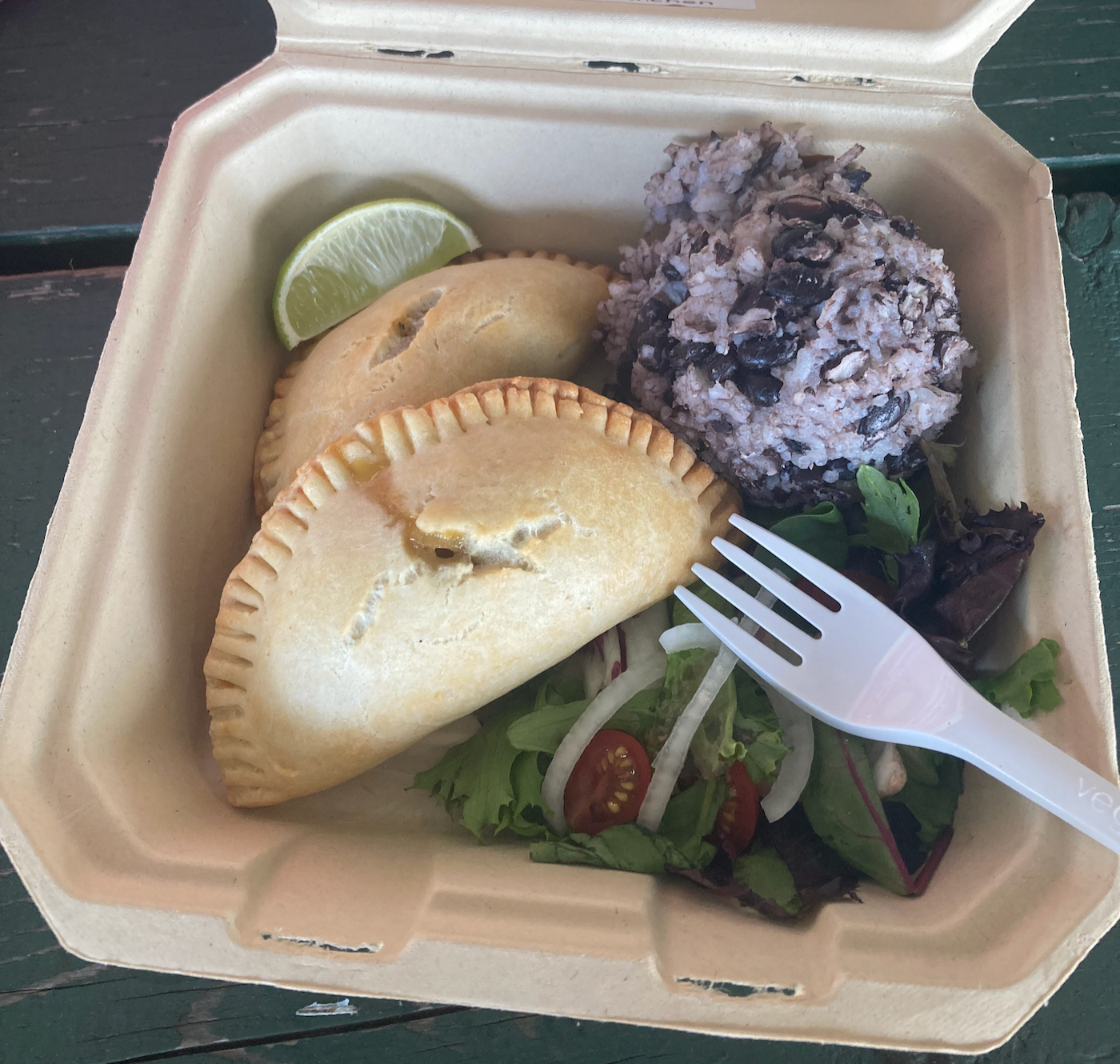
After that the route went a bit further west to Williamsburg center (the furthest west point of the ride), and then started southeast, heading into Northampton. There were a few small climbs which were not too bad – at that point my body was mostly unhappy with being on the bike at all. I made my way through the Florence section of Noho, including riding on the Noho bike path for a bit, and then back north on Route 5/10 to the edge of the city, where I turned east into Hatfield and rode the last 2 miles back to the town center. I reached the finish in a little more time than I did 2 years ago, but it was still a decent showing. At least I got to have a nice meal of sweet potato empanadas:
Thanks again to everyone who donated to the Food Bank for this year’s effort!